Best viewed at 1024 x 768 or higher
1.1
all
images copyright G.MacKenzie & D.Follows 2004
October
2003 Yosemite & Cathedral Range trip
Getting Started
Well, this year my frequent hiking buddy and I decided to plan a longer
and more strenuous backpack hike in Yosemite. Previous reports also
outline 3-day adventures round-tripping to Cloud's Rest and Sunrise
lakes, but this time we thought a longer trip into the Cathedral Range
would be good to
try.
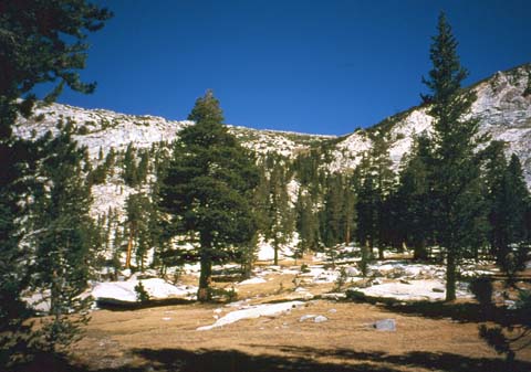
Early October is a good time to get out for mountain exercise, because
the weather is sunny & temperate, with no flying things to be
swatted. Compare this with summer, using descriptive words
written by Tolkien..."clouds of blackflies reeled and danced, while
angry midges buzzed and stung"...I'll take autumn anytime.
As usual, we flew into San Francisco and stayed at the Motel
6 in Fremont across the Bay . This is an ideal place to stay because 1)
it is right at HWY 680 and Warm Spring Blvd. for easy access, and 880
is
1 mile away 2) Along 880 you can easily get to REI in either
Berkeley
or San Jose, and the Fremont REI is only two miles away 3) a big
shopping center is just a few feet away. 4) it is fairly quiet at night
5)and finally, to get going the next morning to Yosemite, just
hop right on the 680 going against all the miles of rush hour traffic
coming in from Pleasanton & Livermore.
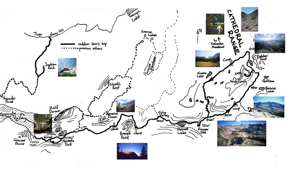
After considering several options, we opted to leave on our hike from
Yosemite Valley, follow the river to Merced Lake, and then branch
off into the Cathedral Range for a loop around Vogelsang Peak,
returning through Little Yosemite Valley again to our base campsite in
Upper Pines. Round trip approximately 45 miles. Elevation from 4000
feet up to 11,500 and back again. Five days and four nights. Good
exercise.
To minimize weight, and to get everything to fit in the 2 bear
canisters, we took as much freeze-dried or dry goods as possible.
Exceptions were
squeeze tubes of honey, jam and peanut butter, my dad's excellent
Christmas
fruit cake, lots of Clif bars/gorp and two 4 oz. tins of chicken. We
pumped
water for breakfast oatmeal and coffee, ate pita and PB/honey/jam/cake
for lunch washed down with Gatorade lemon, and for dinner cooked up
variations
of spaghetti (Knorr dried soup/sauces), and other pastas. No beer this
trip sad to say.
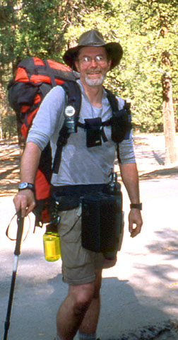
With all our stuff, including ultralight tents (Microzoid & Sierra
Designs UltraLightyear CD) and cameras, pack weights were a little
above 50 lbs, which is a lot more manageable than my first trip up
Nevada Fall with 85 lbs several years ago.
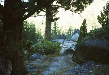
Off We Go
We started off from Upper Pines shortly after first light. Leaving
from the valley (altitude 4000') is a lot more work than going to
Vogelsang from Tuolumne Meadows (altitude 8580'), but it has good
warm-up
timing: a flat stretch (pun intended) along the access road to Happy
Isles,
then your corpuscles really start to circulate as you start up to
Vernal
Fall. There's no need to carry any more water than you need for
sipping,
as it's always available from the river, and even at the drinking
fountain
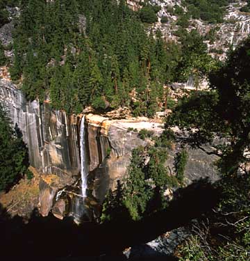
at the first bridge. Up past the Fall itself , the sunlight catches the
water after its plunge.
Vernal Fall
A couple of hours later, we stop for lunch at the top of Nevada
Fall (5980'), having taken the John Muir Trail to the top,
instead of the granite staircase on the north side of the river. And
then on through Little Yosemite Valley toward Bunnell point. Once you
get through LYV (6100'), the slow and steady climbing begins, first
through the heavy woods, and then as
the trees thin out a bit from time to time.
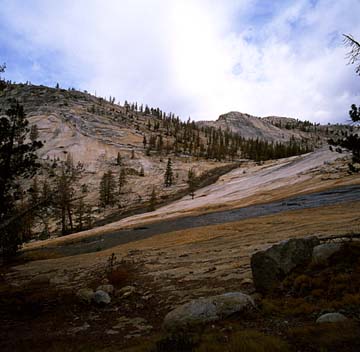
Approaching The Cascade
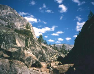
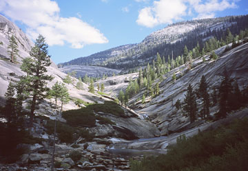
Coming round Bunnell Point at 4-ish in the afternoon, a good set of
switchbacks awaits you, as you climb up out of the river canyon. Before
you start, pump some water for dinner and breakfast. (As it turned out,
there was a small stream near where we camped later, but it may not
always be running.)
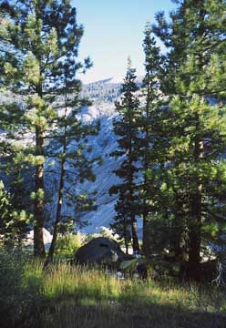
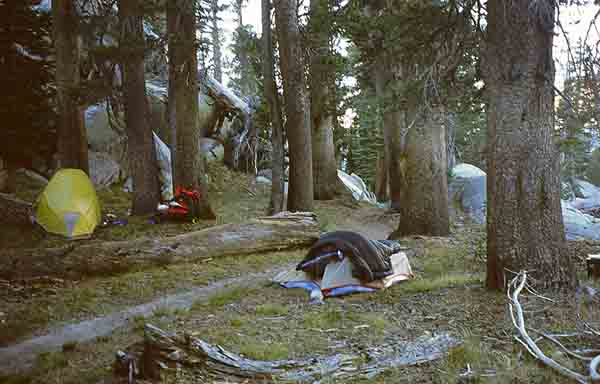
At the end of this first day, we were ready to find practically
the first flat spot to pitch our tents on, but we stuck to it on the
trail through the switchbacks until arriving at the local
trail "top" (7120') , which opens out into large expanses of granite
that slope down and eventually steepen into the canyon. Within 300
yards of this opening out, we found a grove of trees just 50 feet left
of the trail, with ideal views, good grass and a stream right at the
trail. The GPS coordinates are:
N37deg 44.180' W119deg 27.408'
highly recommended
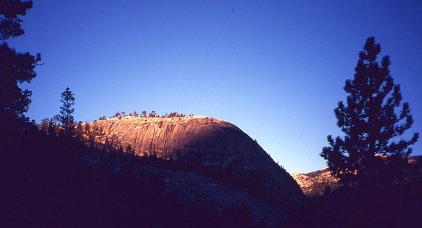
Sunrise on Bunnell Point
The next morning at 9 a.m. we pressed on under sunny and warm skies
through Echo Valley (10 am) toward Merced Lake.
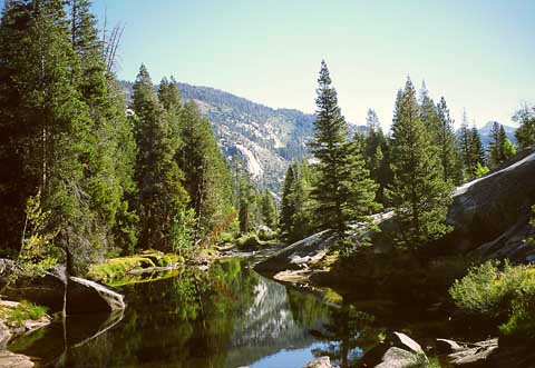
Merced River
At noon, we stopped at the far end of the lake for lunch, right on
the water's edge at the High Sierra Camp. The tents there had all been
set down for the winter, and we met only one fellow hiker and later on
a bear ambling along the other side of the confluence 200 yards away.
He
was just strolling and minding his own business, then off into the
woods
he went.
All afternoon the sun just beamed down, making for a warmer than usual
October day. We headed on the trail toward the Ranger station,
where the heavy climbing begins again as we follow the gorge of Lewis
Creek.
By the ranger station, the elevation is 7320'. So basically, from the
Valley, it has been climbing 2000 feet fairly steeply to the top of
Nevada Fall (6000'), 5.5 miles gently sloping flat along to the start
of Bunnell switchbacks (6700'), up the switchback 0.5 miles to
7100' , then 4.5 miles to the ranger station at 7320 feet.
We made our way up the switchbacks to 8200' where the Fletcher Creek
trail branches off to the left, and then followed the Lewis Creek
trail, which stays pretty close to the water, at least close enough
that you can frequently hear it. You can't see it though, because the
ravine is fairly steep and heavily wooded.
By 4:30 it was time to set up camp: we were about a half mile
downstream of the Florence Lake tributary, which would've been
reachable had more water been needed. Right along the trailside we
camped, in a sheltered spot. Above our campsite were terraces ideal for
cooking and higher up
you could get to clear sky for satphone calls.
Location:
N37deg 45.279' W119deg 21.457'
Now we're within shooting distance of Vogelsang. Our plan for the day
is to get to the peak.
We make our way up the canyon past the Florence Lake stream up to the
Bernice Lake trail junction at 9840'. The open meadows afford views of
the upcoming pass and we stop for a few minutes to chat with a young
guy who is out on his way to Merced Lake. So far, in two and a half
days since Little Yosemite Valley, we have met two hikers coming over
from Red Peak, a fisherman hiker and a backpacker at Merced Lake, a
traveler at the Fletcher Lake
cutoff, and this young man...a total of six people. Quite the
comparison to Little Yosemite Valley and the falls areas!
The meadow before Vogelsang Pass
By now it's getting toward midday and the sun is quite warm. We start
up the switchbacks, and soon there's no doubt you're getting up there.
You look back, and can almost see the treeline below you.
Later on, looking back you see Bernice Lake. With the saddle above
and behind you , you're looking southeast toward the lake, and this
morning's meadow below the sightline at right of the picture.
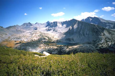
And a bit to the left, you see Gallison Lake
Gallison Lake
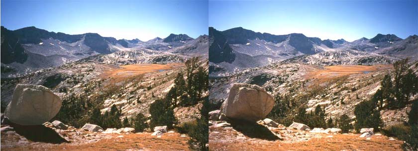
For people who like to see things in perspective, here's a stereo pair
of Gallison Lake with Mt. Lyell and Mt. Maclure in the distance, taken
at a lower elevation. To see it in 3-D you need to cross your eyes and
find a distance from the screen (typically 8 to 20 inches) so that a
third ,
central image emerges in 3-D. You have to be looking straight onto the
images dead-center left to right, and no head-tilt. There is a sweet
spot
of about 1 inch side to side where you can get the effect.
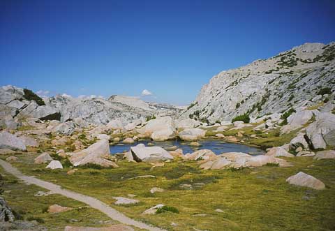
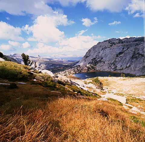
Finally, you make it over the saddle at 10640' and come upon a pretty
little pond next to some large talus. It's a good spot for a rest and a
snack.
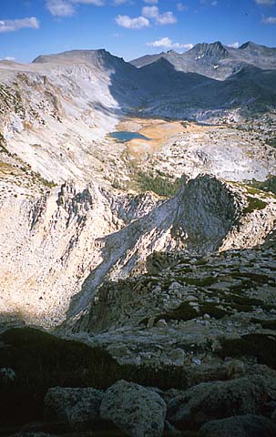
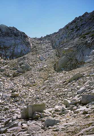
A few hundred yards further (very windy...watch your hat) and you can
look down on Vogelsang Lake, and up to the right at the peak. The
jumbled rock field is deceptive. Some of those chunks past the green in
the middle distance are the size of a bus.
At about the midpoint in the next picture, drop your packs for the
rockscramble to the upper saddle on the way to the real peak. (***Make
a careful mental note where your pack is, and make sure to look back as
you climb to keep its position in perspective; otherwise you may be in
deep trouble finding it. From the top, you have no chance of seeing it
without binoculars***)
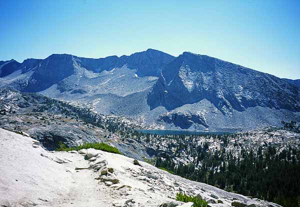
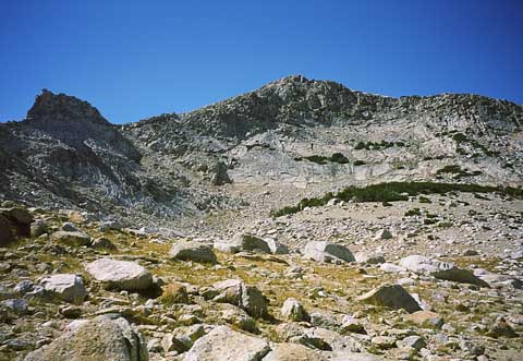
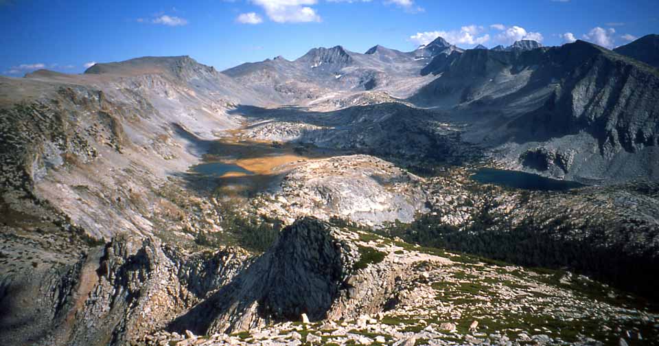
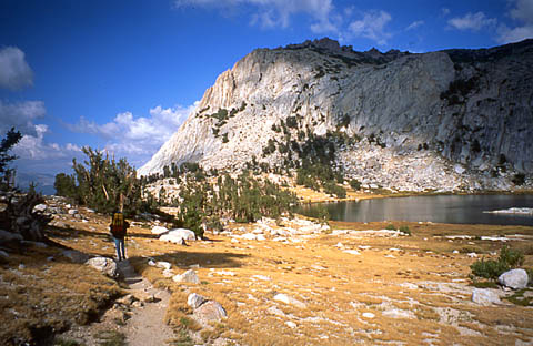
Now it's up to the top, by finding pathways and stepping stones between
the heavy ground bushes. And in a broader view, we can see Bernice Lake
on the right, Gallison Lake on the left, a string of smaller lakes
above Gallison in the shadows, and Mt. Maclure and Mt. Lyell in the
distance. We
came up the chute from the hidden lower-left, and emerged onto the
saddle in the foreground just right of the shadowed cliff face in the
middle.
Toward Mt. Lyell and Mt. Maclure
Reaching the top at 11,496', it's time to have a seat for a few minutes
to enjoy the magnificent vistas. Here, Dave catches a few rays.
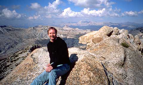
And meanwhile, I find and fill in the record book in the ammo box .
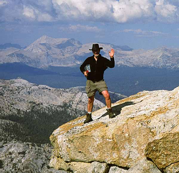
To the east is Half Dome in the distance, 10 miles away.

Finally, it's time to head down and get moving toward the night's camp.
As we get out of the chute and into the basin, ready to rejoin the
trail, Vogelsang Lake looks pretty close, and pretty soon, it is.
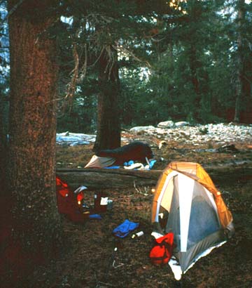
We follow the trail into the High Sierra Vogelsang Camp, which
has some very nice buildings and a pretty impressive outside
fireplace/oven. Down the trail toward Emeric Lake and Fletcher
Creek, we stop for the
night next to the water, with a small waterfall to keep us company.
Location N37deg 47.275' W119deg 21.514'
The next morning, we head off past Emeric Lake, and through grassy
meadows.
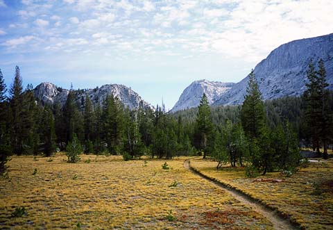
We continue to follow along Fletcher Creek all the way down the
switchbacks to Merced Lake.
Again it is lunch-time, then off we go through Echo Valley,
past our first-night campsite, and around Bunnell Point. We stop for
the
night near Moraine Dome, about 20 minutes outside the Little Yosemite
Valley boundary. (location: N37deg 46.930' W119deg 28.831').
A good campsite not far from water, with a great view of the valley
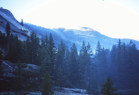
The following morning (Day 5) brings us a morning vista of smoke
rolling gently down the hills into the main valley before us. The fire
crews had been busy up toward Mt. Starr King all night, with the light
of
the fires visible reflecting off the low cloud.
We continue along through LYV to Nevada Fall. This time we go down
the Mist Trail way, passing lots of day-hikers going up. It's very
sunny
and quite warm, never mind that it's early October.
So finally, Upper Pines beckons, at about 4 in the afternoon. You can
just imagine how good a few beers taste, especially combined with a
favorite Degnan's pizza in the Loft!
So in summary, this main hike took us 45 miles round trip from 4000' up
to 11,500' and back again. And perfect summer-like weather to boot,
even though we were prepared for sudden snowstorms.
Now usually on these trips, it's nice to do a relaxing day trip or
two, and then finally head out to some vastly different terrain. Before
leaving Yosemite proper, we headed out on the Tioga Road to
Porcupine
Flat. At this time of year, overnight parking had just been suspended
for
the winter, 'cause you never know...and if heavy snow closes the road
some
night (for the winter) your car will be home for any number of bears
until
springtime! Stopping a mile past Porcupine Flat, we made a day trip to
Indian Ridge, where I had been a few years ago up via Yosemite Falls
way.
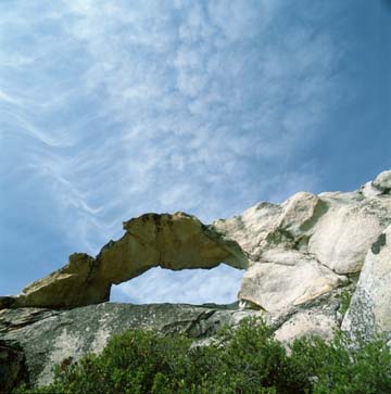
This time, we explored the Window Rock, which surely was and is a place
of reverence to the Ahwahnichi, Southern Sierra Miwoks and Paiutes.
Indian Window Rock
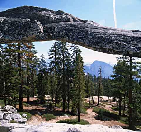
At almost 8500', you can gaze through the window across Tenaya Canyon
at Half Dome
And so ended the Yosemite portion of our trip.
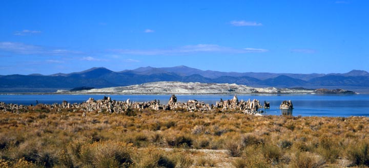
After a restful last night in the valley, we headed out along the Tioga
Road to Lee Vining. As usual, the Whoa Nellie Deli had excellent food
and a wide variety too. The Chef and everyone behind the counter still
sport clean & pressed white aprons, and it would be a sin not to
sample the place. You can sit outside and look at Mono Lake in the
distance, while thinking about upcoming adventures.
Mono Lake
Heading south on 395, we spent the night in Bishop. Let's just say
that there are several nice looking motels there, and next time, I'll
definitely choose one of them instead of the Motel 6 there. The room
was fine, but the price was a damn sight too high.
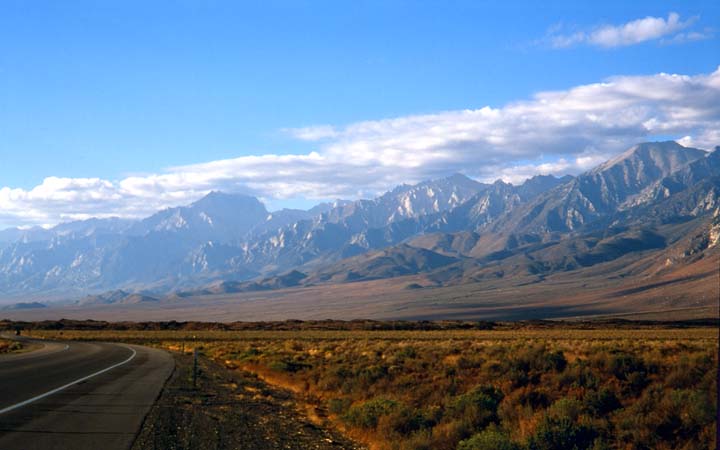
Anyway, the next day we pressed on towards Lone Pine, stopping
for a morning photo.
Along the border of the Range of Light
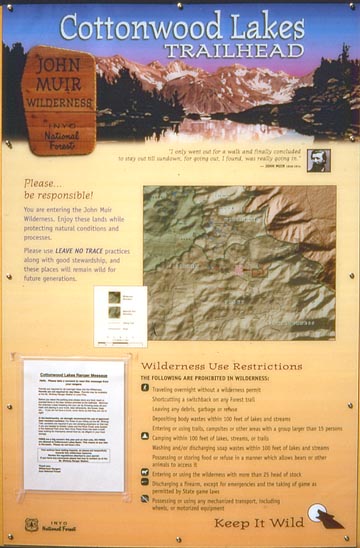
At Lone Pine we took a side trip up Horseshoe Meadows Road to the
Cottonwood Lakes trailhead.
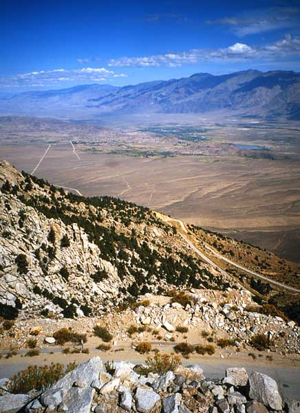
You can see Horseshoe Meadows Road from the 395. It switchbacks up
the Sierra eastern face just south of Lone Pine. This is what Owens
Valley
and Lone Pine looks like from the top of the road.
Onward to the Panamint Mountains
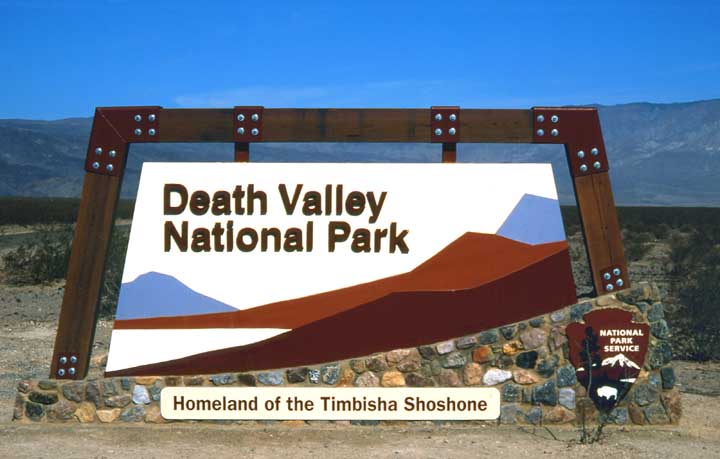
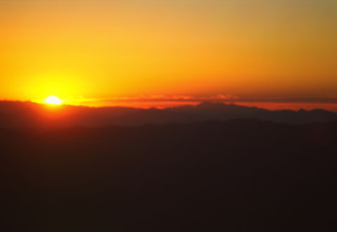
Now it was time to head east and up into the Panamint range, back to a
favorite camping spot high in the mountains. There is a new sign that
very well matches the terrain and beauty of the Death Valley area:
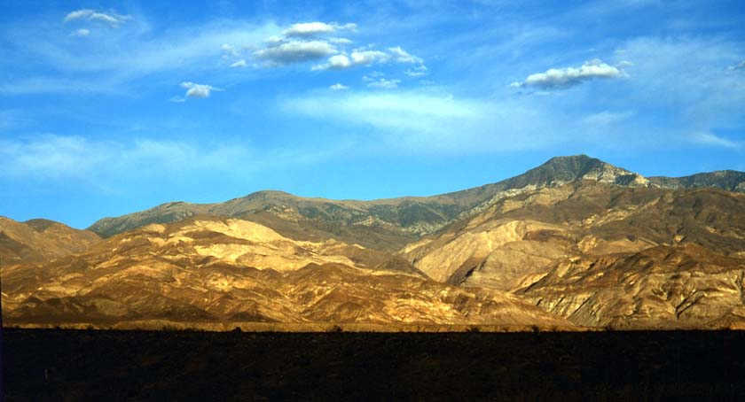
And in the afternoon sun, we can see Telescope Peak, and imagine
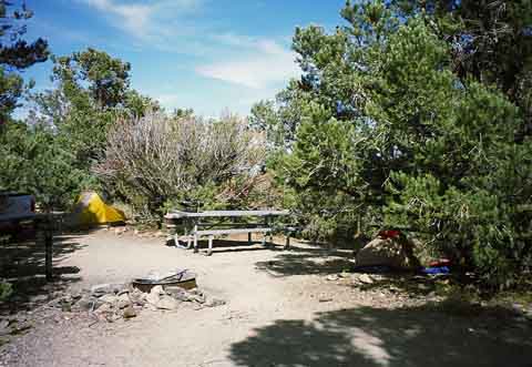
Mahogany Flat Campground (8133') on a small plateau at the left side of
the photo...
This time, the campsite was almost empty (as usual)- not like this
past May when everybody and their brother was there (see May 2003 Trip
report).
So we had a great salmon dinner with beer, and packed it in.
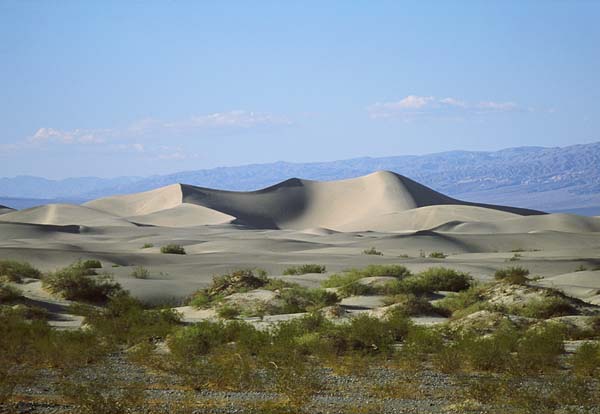
In many earlier reports, I've detailed and shown lots of Death Valley
National Park pix, and hikes to Telescope Peak. This time, let me just
remind you of the beautiful sand dunes, before we head back to
San Francisco
So finally, we headed back to San Francisco, this time by way of the
Sonoran Pass, north of Lee Vining and the Tioga Road. Let's just say
don't even think about doing it with a little car or a trailer. At one
point
the sign says "26 degree grade ahead". And then there are the snow
posts,
usually 8 feet high, but in some places they're welded end to end
3-high,
so the plows can know where the road is when the spring comes...and all
this on very steep mountain switchbacks.
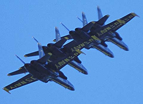
We spent the last outdoor night at the Deadman Campground after going
over the ridge (not literally). Then the next day we made it back to
the Bay area for a day or two of city-type R&R. Among the things we
enjoyed was a performance of the Blue Angels over Golden Gate Park and
Fisherman's Wharf. Dave caught 4 of them flying in close formation with
a telephoto. Talk about skill and good timing on everyone's part!!
So that's it for 2003. I hope you enjoyed the story and the pictures,
and perhaps they'll encourage you to book a camping trip to Yosemite
and the Range of Light. God willing, I'll come back as often as I
can.
Gordon January 14,2004