The
September 2006 Mt. Whitney Trip Report 1.07
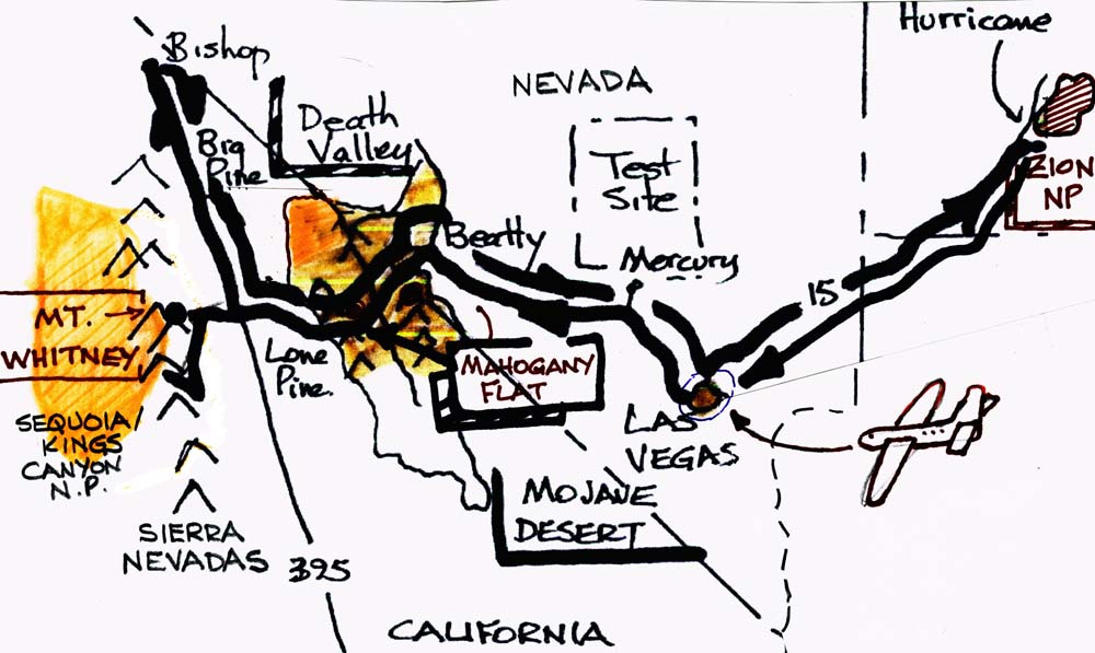
This year, my old friend David and I thought to plan a different trip
from the usual. Rather than arriving in San Francisco and driving
east, we decided to plan a two part trip starting in Las Vegas. First
we would travel north and east to Zion National Park, then over
to the Sierras for some more exercise. For additional pictures and
commentary, have a look at Dave's website: http://dfollows.spaces.live.com/
A Vegas Volkswagen
After a typical landing at McCarron, it was time to do the usual
car rental stuff. If you like average styling and appallingly bad
interior design, then reserve a Chevy Equinox SUV. The first beef is
that the window controls are down in the middle console, so you can
look where you're going, or look for the controls instead. But get
this-the cigarette lighter is in the bottom of the baseplate underneath
the parking brake lever. So when you want to plug in a cell phone
charger, it's very inconvenient. But first you have to find and replace
the fuse under the hood, because loose money on the tray has rattled
around and fallen into it , shorting it out. No doubt the Marketing
Department made that design decision..
Escaping from Vegas, we headed to our motel in Boulder City, just next
door to the Hoover Dam. This is a good first-night place because there
is an REI camping store on Green Valley Parkway just outside town.
We learned a useful bit of info on shipping things this time. Normally,
I ship my little propane campstove head and bear spray via UPS Ground,
and then pick it up the day we arrive. You can do the same thing by US
Mail (Ground) if the box is properly labelled as ORM-D. But this time,
I learned that, strictly speaking, you can only ship such a package
from the UPS hub, not a UPS store. You can ship it TO a UPS store and
have them hold it for pickup, but you cannot send it back home from
there at the end of your trip. So after a lot of wasted time, just use
USPS to and from post offices and forget about UPS.
After shopping for groceries, water, ice coolers and matches,
it's easy to have a good meal and a beer or two, then walk to the Sands
Motel.
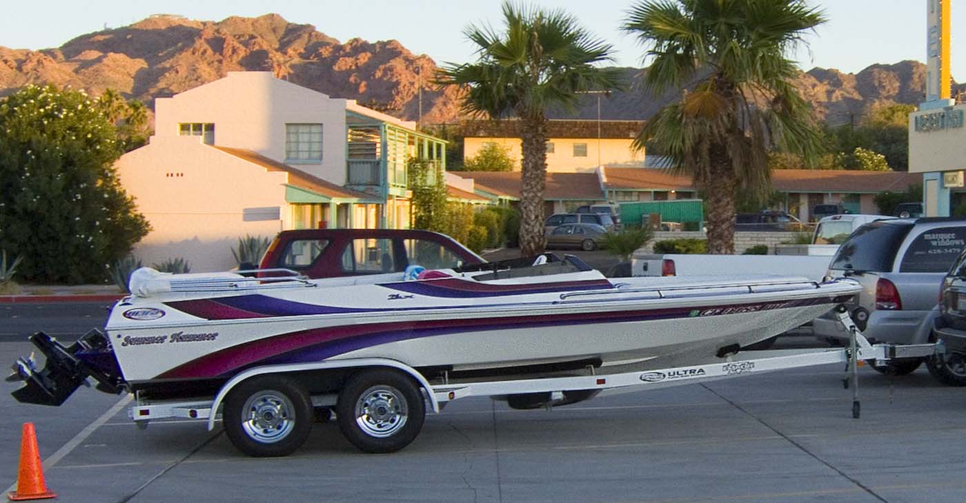
Lake Mead is a very popular destination for the locals, as you can see
from the toys in the motel parking lot:
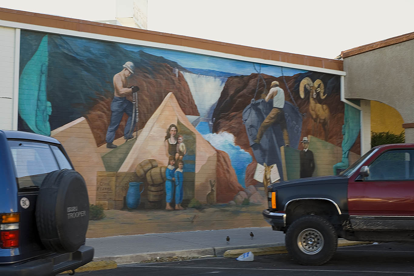
Boulder City (basically a 20 mile distant suburb of LV) is very proud
of its heritage. It's a nice and tidy small town, with shops and good
restaurants all along.
If you want to get a great education in Dam building, and an
appreciation for the effort in large construction projects, take the
extended "hard-hat" tour at the Hoover Dam…
More info at http://www.usbr.gov/lc/hooverdam/service/index.html
Now, David had not yet been to the high desert areas of Utah, so a
couple of hours drive to Zion National Park was a greater staring off
point. We camped at the riverside Watchman campground and enjoyed sunny
weather, although at one point it looked like there was going to be a
big dumping. One of the survival rules in desert hiking is to watch
rain forecasts very carefully, because flash floods are common,
especially in canyons. http://www.nps.gov/zion/
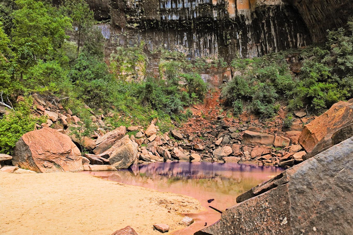
Our first mini hike took us to the Emerald Pools, in the shadow of
sheer rock walls,
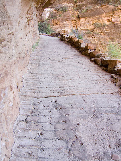
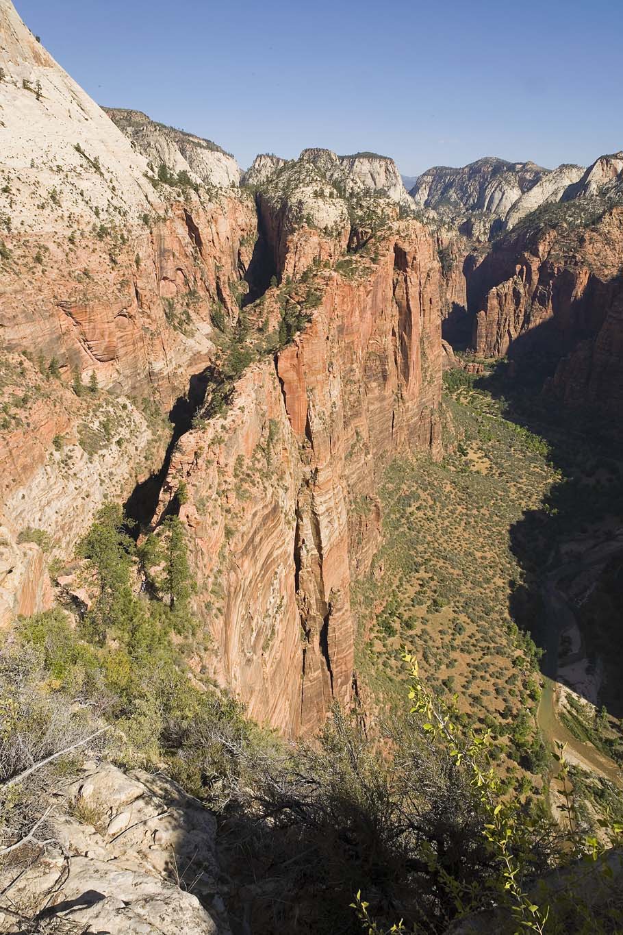
The next day, we took a day trip up to Angel's Landing and enjoyed the
scenery on another cloudless day. On the way up, there is a section of
trail cut into the side of the rock. It's fairly steep and so is
stabilized with concrete under foot. Look closely at the picture- the
deer also used it before the concrete hardened!
Looking down the Valley toward the campgrounds
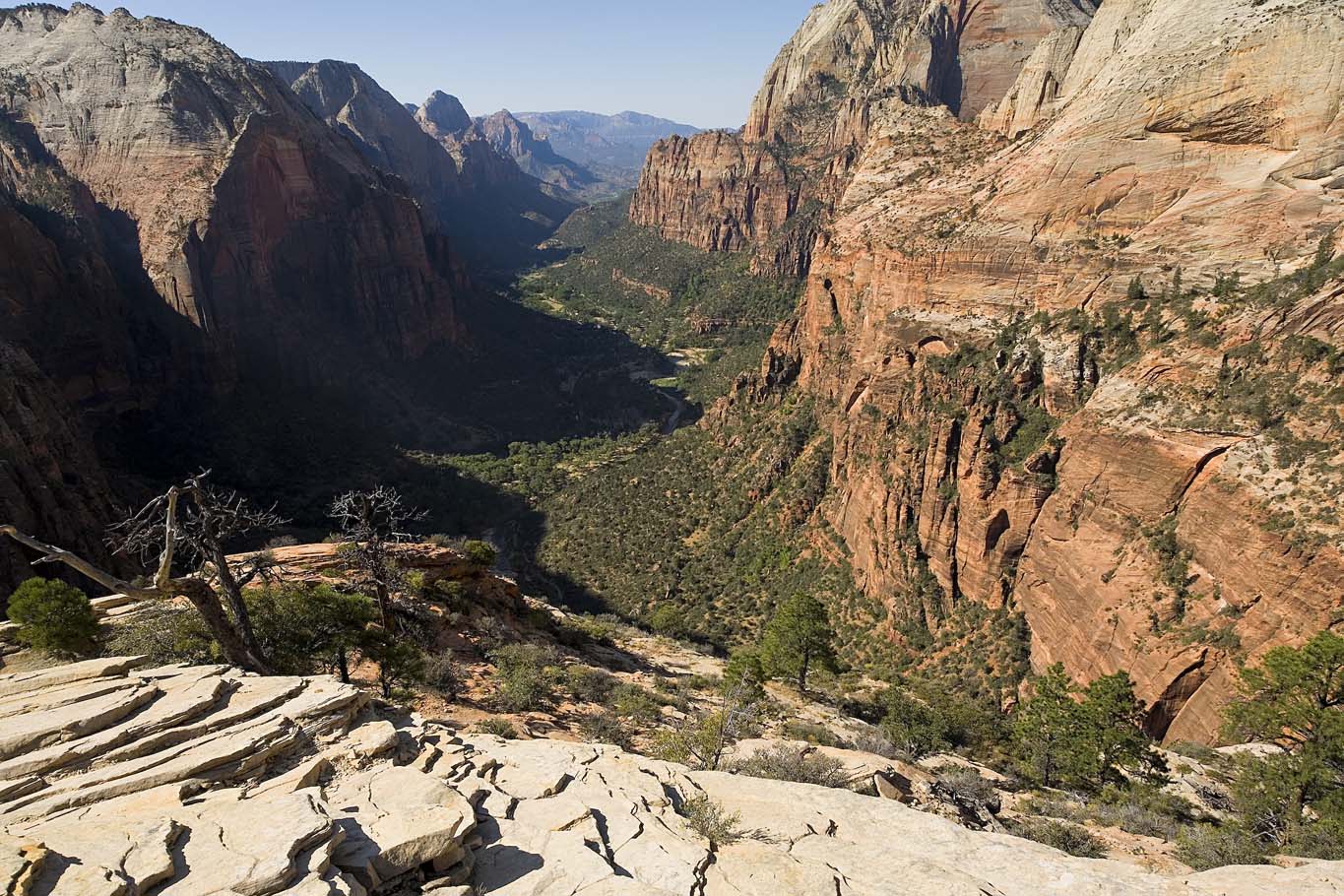
and looking the other way, toward the Temple of Sinawava and The Narrows
After our successful day at Angel's, we used Zion as a base for
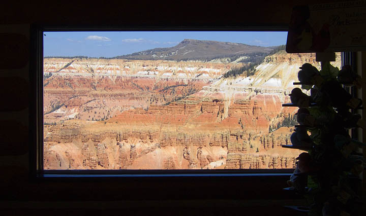
trips to nearby other parks within short driving distances. Cedar
Breaks was good to see again, this time without the snow squalls. The
Park Office looks out directly into the hoodoo vista. http://www.nps.gov/cebr/
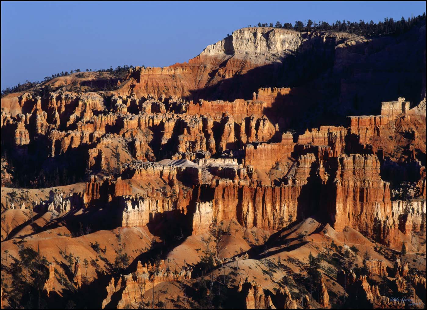
A similar and even more extensive panorama of sandstone spires and
erosion awaits at Bryce Canyon. http://www.nps.gov/brca/
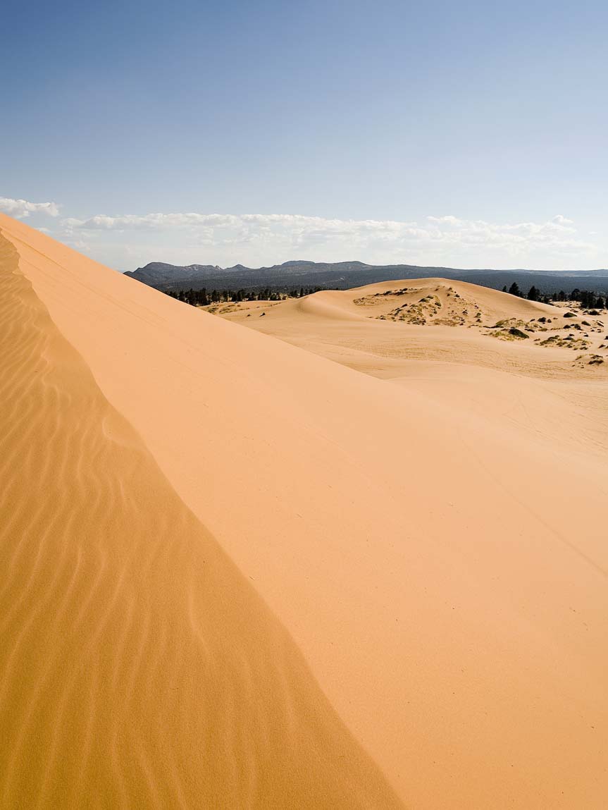
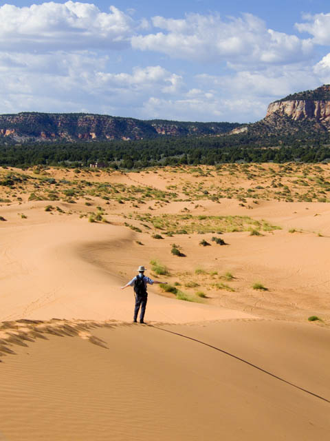
Our third visit was to Coral Pink Sand Dunes State Park. http://www.stateparks.utah.gov/park/index.php?id=CPSP
A happy
accident of geology set up a gap between two expanses of
high land at one end of the park-the prevailing winds carry fine
sand many miles up through this gap, where the grains deposit to form
ever-moving dunes in an area of wind eddies. You have to see them to
believe 'em.
At the dunes, there are a few perfect BBQ and picnic table spots,
just a short hop from the campsites.
So then we left Zion and retraced our steps through Vegas, and spent
the night in Beatty Nevada Motel 6 for a rest. Then it was off to
Mahogany Flat in the Panamint Mountains (inside Death Valley National
Park, surprisingly enough http://www.nps.gov/deva/
. Check out the latest "Visitor's Guide" on thaat website page).
Our basic plan for the main event of climbing Mt. Whitney, was to spend
a few days in warm up hikes, and especially to spend time at increasing
altitudes to acclimatize. Many people feel ill effects of AMS (Acute
Mountain Sickness) if they don't do this. I know from past trips
that acclimatizing helps me a lot.
For anyone interested in Mt.Whitney hiking, a bit of planning is
essential, since a permit is needed, and these are assigned several
months in advance by lottery. For the 2007 hiking year, mailed letter
applications (no faxes anymore) must be postmarked and received in Feb
2007 to participate in the lottery. After that, it's hit or miss. To
learn more about Mt. Whitney and the John Muir Wilderness, or the
permit process, go to:
http://www.fs.fed.us/r5/inyo/recreation/wild/mtwhitney.shtml
It's part of the Inyo National Forest website.
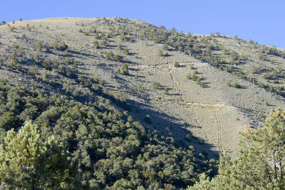
There is a nice 14 mile round trip hike from the 10 campsites at
Mahogany Flat up to Telescope Peak and back. Look at earlier trip
report #6 October 2002 to read lots more about this
area. It's a favorite. So we drove up
to 8133 feet elevation (at the MF campsites) since the road was
again good enough to get up there in our SUV, then did the hike, and
camped there that night.
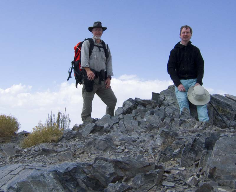
At the top:
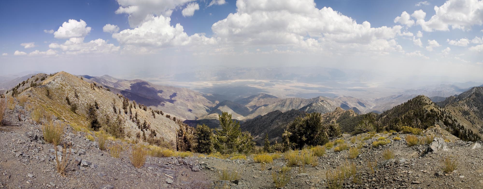
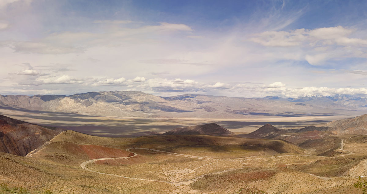
Here's a panorama of the Telescope Peak vista looking east. The weather
was perfect the whole day, and we chatted with a few hikers, painters
and geologists along the way.
That night the wind Blew Like Hell. It was the kind of wind that would
blow your empty tent out of sight in a couple of seconds if it got
hold. But no rain, just heavy wind. This was a message from western
areas about their weather (though we didn't know it at the time).
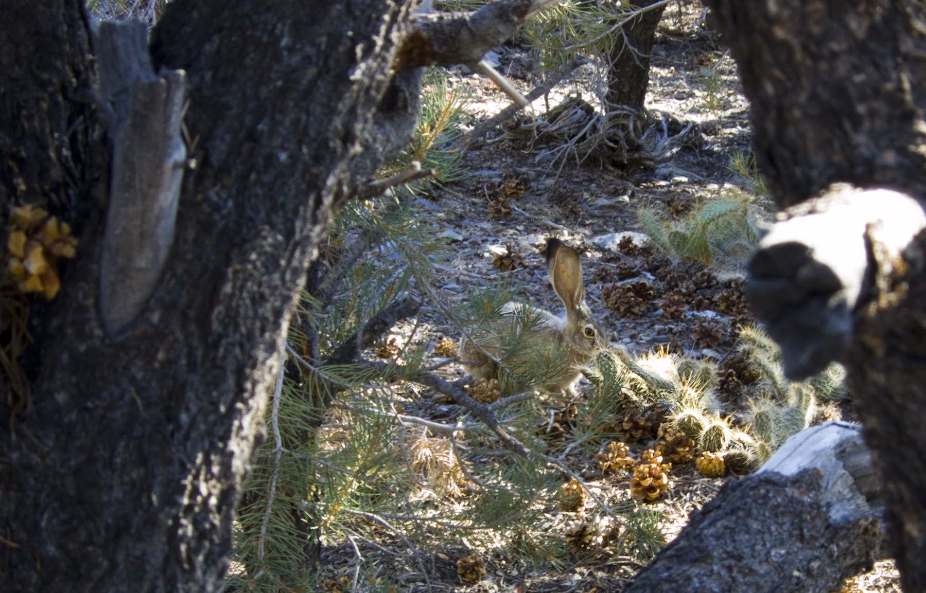
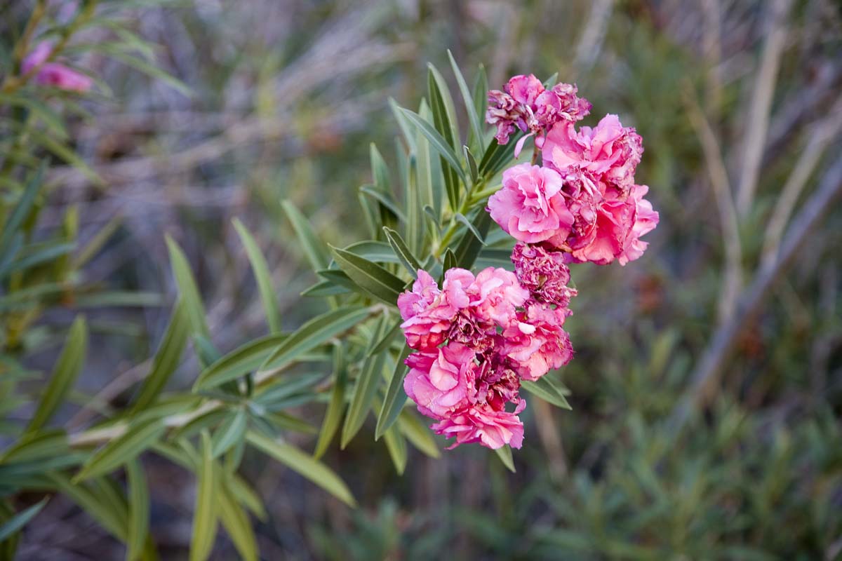
The little cactus garden gets an inspection from the local Hare.
From the campsite, we prepared to head down the next morning. Now,
across the way, there is an narrow access road switchbacking up the
side of Roger's Peak, up to the solar powered microwave repeater at the
top. Take a good look at the next picture. You can see a game trail
cutting down the side, but there's another set of tracks. It looks like
a trailer or car went off the track and made a direct and bumpy ride to
the bottom. No turning around on these "roads".
Getting down toward Emigrant Pass, we stopped at the Wildrose Spring
for a break.
Then off we went west. Another perfectly sunny day. Looking back from
Father Crowley Point, we could see Telescope Peak way off across the
Panamint Valley. In the picture below from an earlier trip report, you
can see snow on the top of it.
After crossing Owens Valley, we went up to Horseshoe Meadow for two
nights camping at 10,000 feet before starting our big hike. It got
chilly (14F) and a bit windy that night. During the next day we went
down into Lone Pine for supplies and could hardly believe the wind.
On the main drag through town people were walking with their heads
down. Some were wearing bandannas as masks. Paper and other stuff was
blowing out of store doors into the street. If you looked down the
street, you were expecting to see rolling sagebrush and Clint Eastwood
riding out of the dust clouds. It was not good. You sure wouldn't want
to take your camera out. Again this was an indicator of the heavy
western weather all the way down from Oregon that had been plaguing the
western seaboard for a several days. .Before departing Lone Pine, we
learned that peak winds were over 90 mph at the mountain crests.
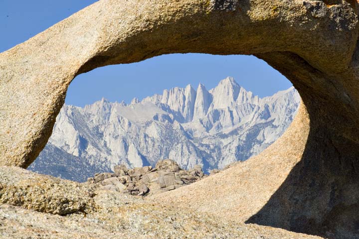
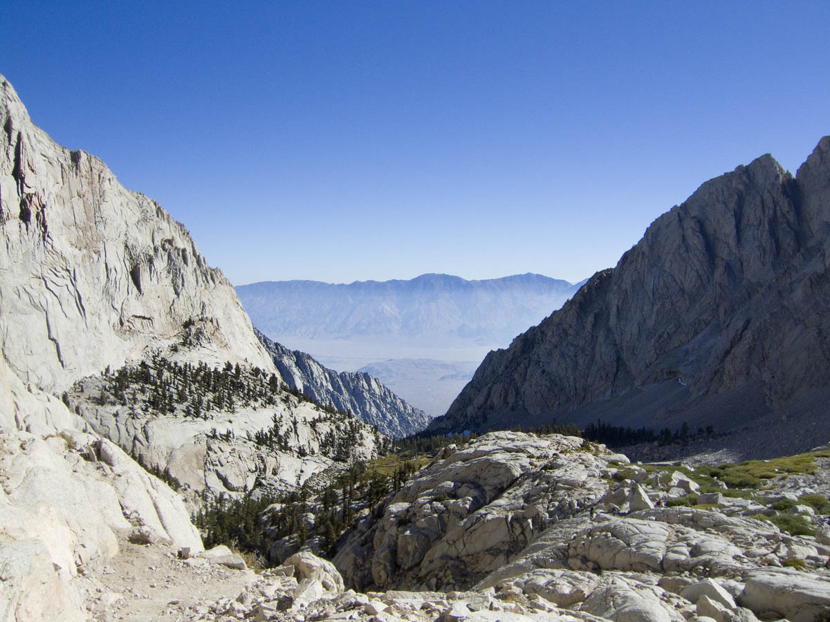
The view of Whitney from the Alabama Hills:
Packing up early the next morning, we then headed down into the valley,
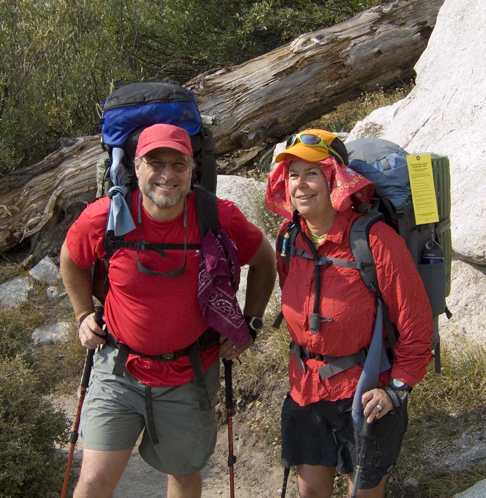
then back up to the Whitney Portal parking area to start our hike.
Another beautiful sunny day, and we lucked into a parking spot right at
the trailhead. Perfect.
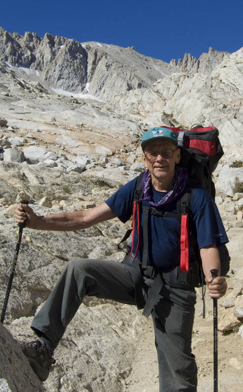
So off we went. Our plan was to camp two nights at successively
higher elevations, then summit on the third day, with a spare day
if needed. Then we would retrace part way before camping again.
Starting up the switchbacks:
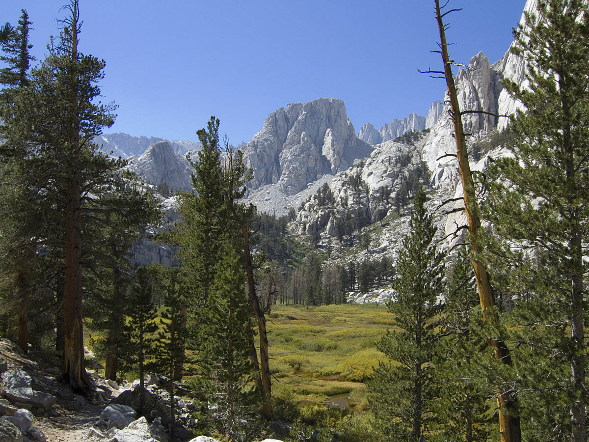
Basically the first part of the route follows the general path of Lone
Pine Creek, up mild cuts or canyons, alternating with meadows now and
then.
And again, a half hour later
Switchbacks are good exercise going up from the trailhead. For people
not accustomed to going uphill with a pack, the first few miles can be
a trial. This sleeping guy was well camouflaged, about two miles up the
trail.
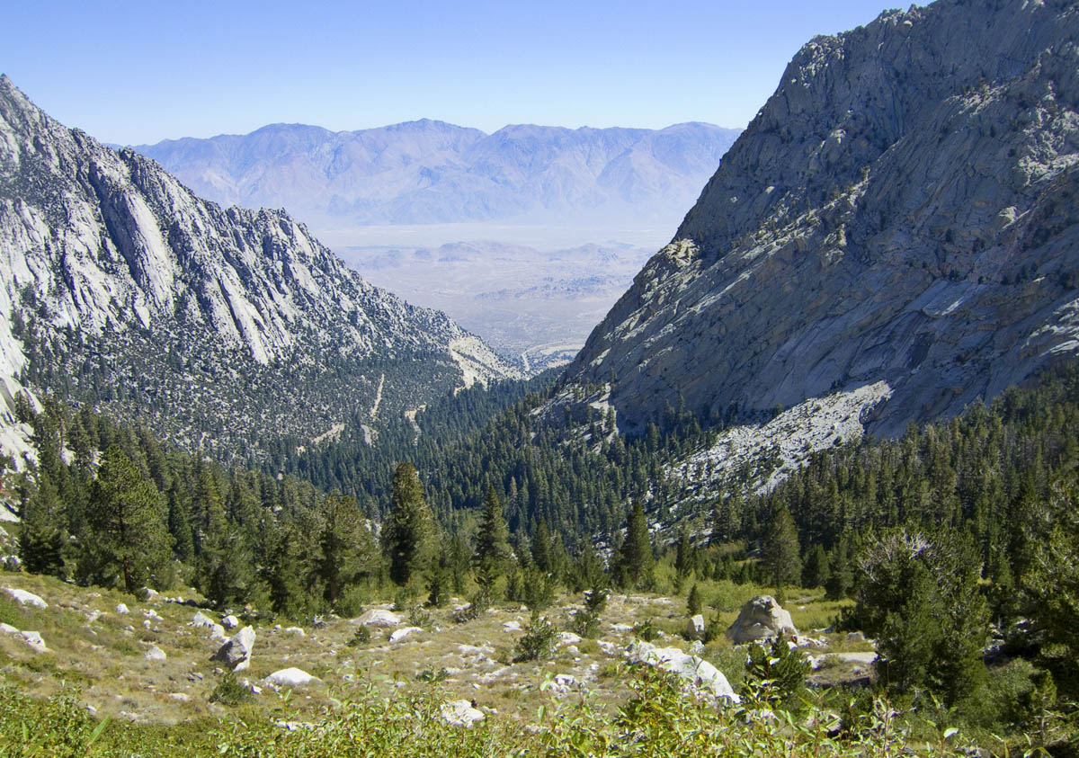
A while later is the first major point of interest, Lone Pine
Lake. It sits almost perched on the edge of the flat, overlooking Owens
Valley below.
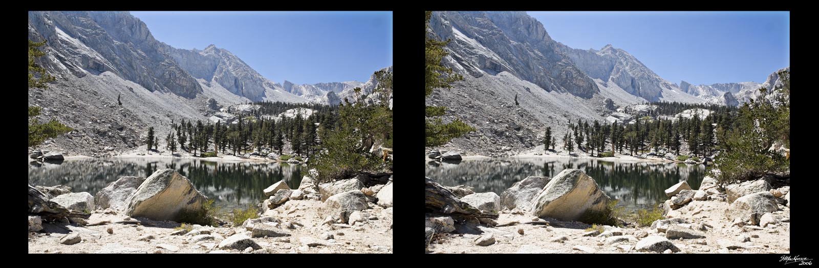
Turning around and looking up the trail, you can see the ridgeline.
This is a stereo pair. With a bit of practice, you can see in 3-D. At
normal distance from the screen, cross your eyes and experiment until
you see a third image in the middle of the other two. Then the effect
should click in for you. There are more of these to come…
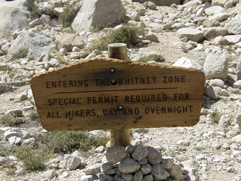
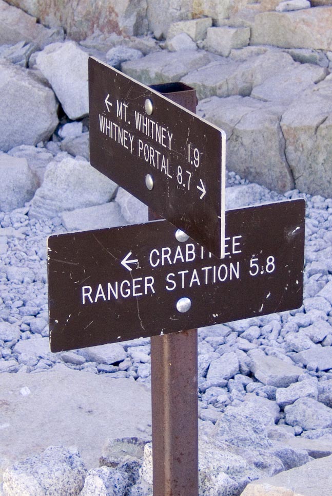
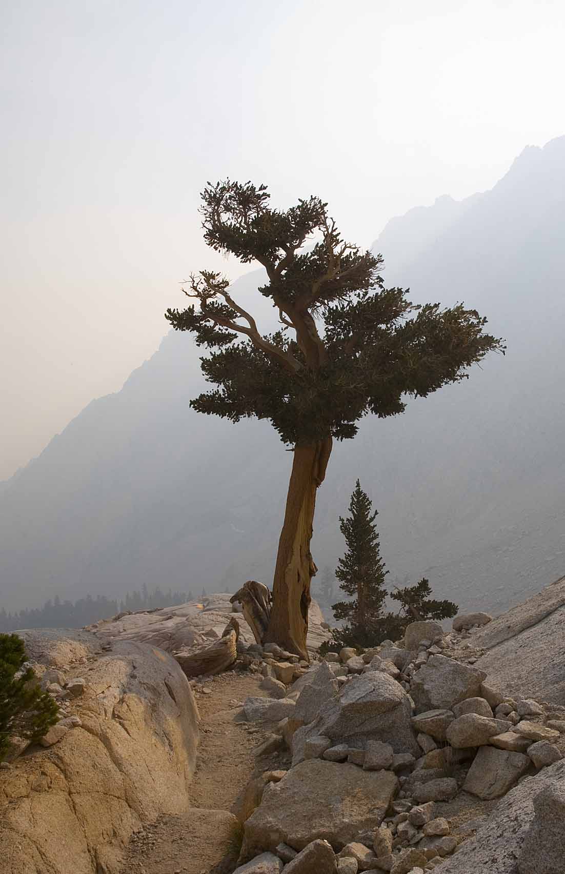
Up the trail a bit further, the trees start to thin out a bit, and you
pass the sign:
At the next "landing" there is a very lush alpine meadow.
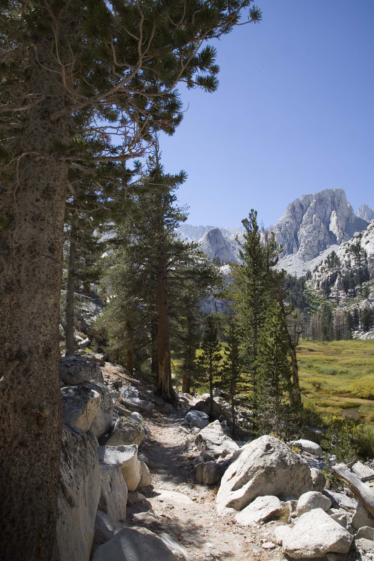
I'm on this nice trail, dappled with sunlight when I come around a
corner and meet this guy:
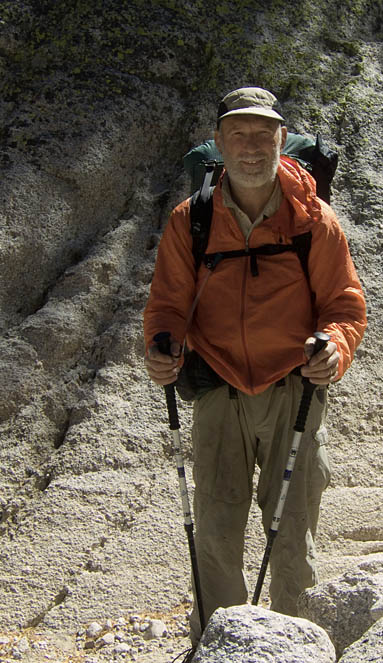
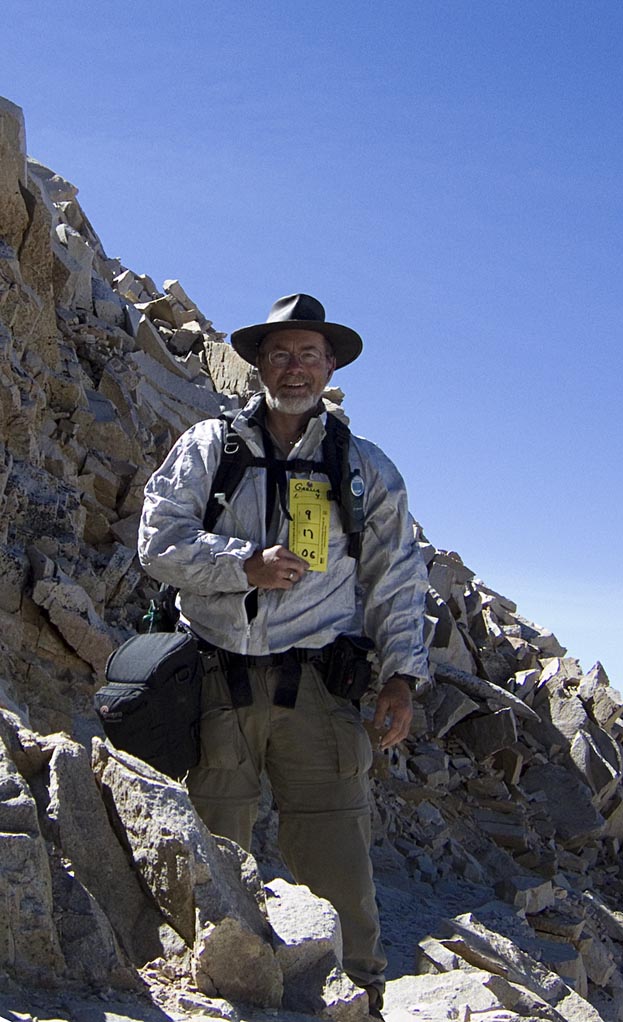
What a story! He had been a month out on the John Muir Trail, coming
down from Yosemite. Last night, he was caught on the backside trail up
at 14000 feet, pinned to the wall by the strong winds . To live
through the night, he crawled on hands and knees to cobble together a
rock cairn around him to keep from being blown off. When I told him of
the wind speeds, he didn't bat an eye. He already knew first hand.
Now,here was a seasoned hiker, well prepared for the extreme weather
changes. He had done numerous treks in his time, and now figured this
was a good way to finish up on big trips. From now on, "I'm going
to spend time traveling around in luxury on my Harley". I wish
you well on all your future journeys Sir!
Mt. Whitney is still a long way away, hidden round behind, on the
right. At the end of the meadow is Outpost camp, our first night's
accommodations.
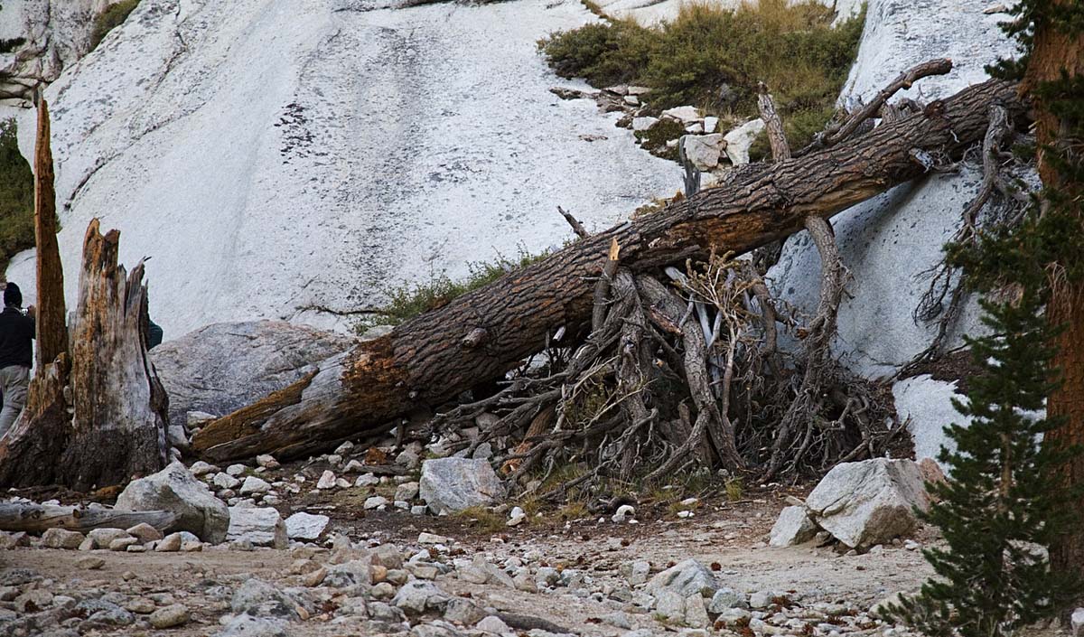
Some adventurous people decided to make a lean-to, and they did a
pretty good job of it.
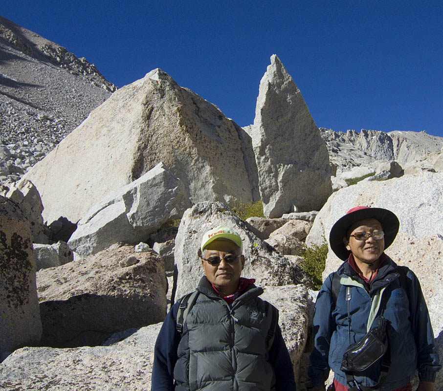
Breaking camp the next morning, I meet two guys taking a break,
acupuncturist Dr. Moon and his long time friend T.C. It turns out that
T.C. has a long history of hiking - he has traveled throughout
Patagonia, and many years ago hiked the Silk Road in Asia. Now that's a
trek! Best Wishes to both you guys!
And a short while later, a gent from Bucks County Pennsylvania, out for
some photography with his buddies.
On this look back, you can just see a bit of Lone Pine Lake. Outpost
Camp is hidden way down behind the hillock.
Heading up the trail, you can see the trees have stayed behind. And
people are so small as to be left invisible against the rock.
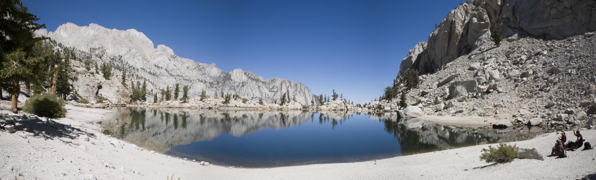
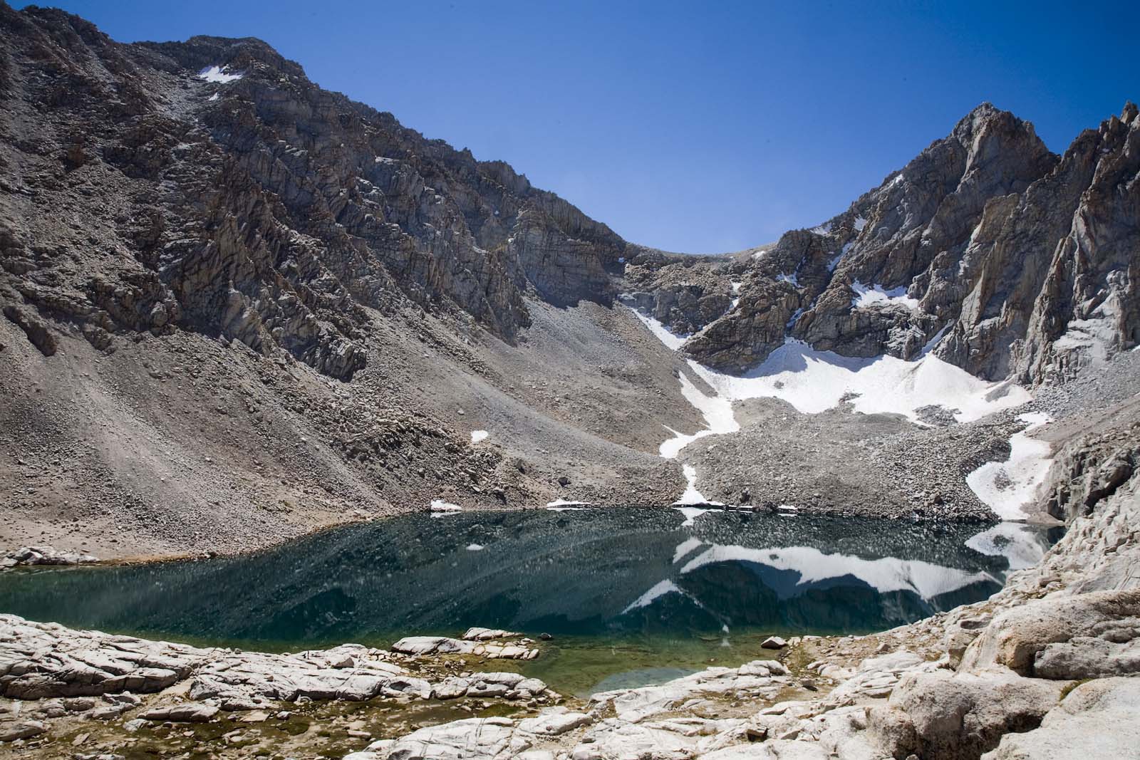
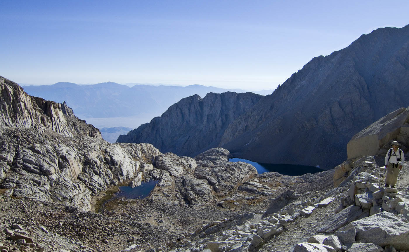
And a bit further up is Consultation Lake
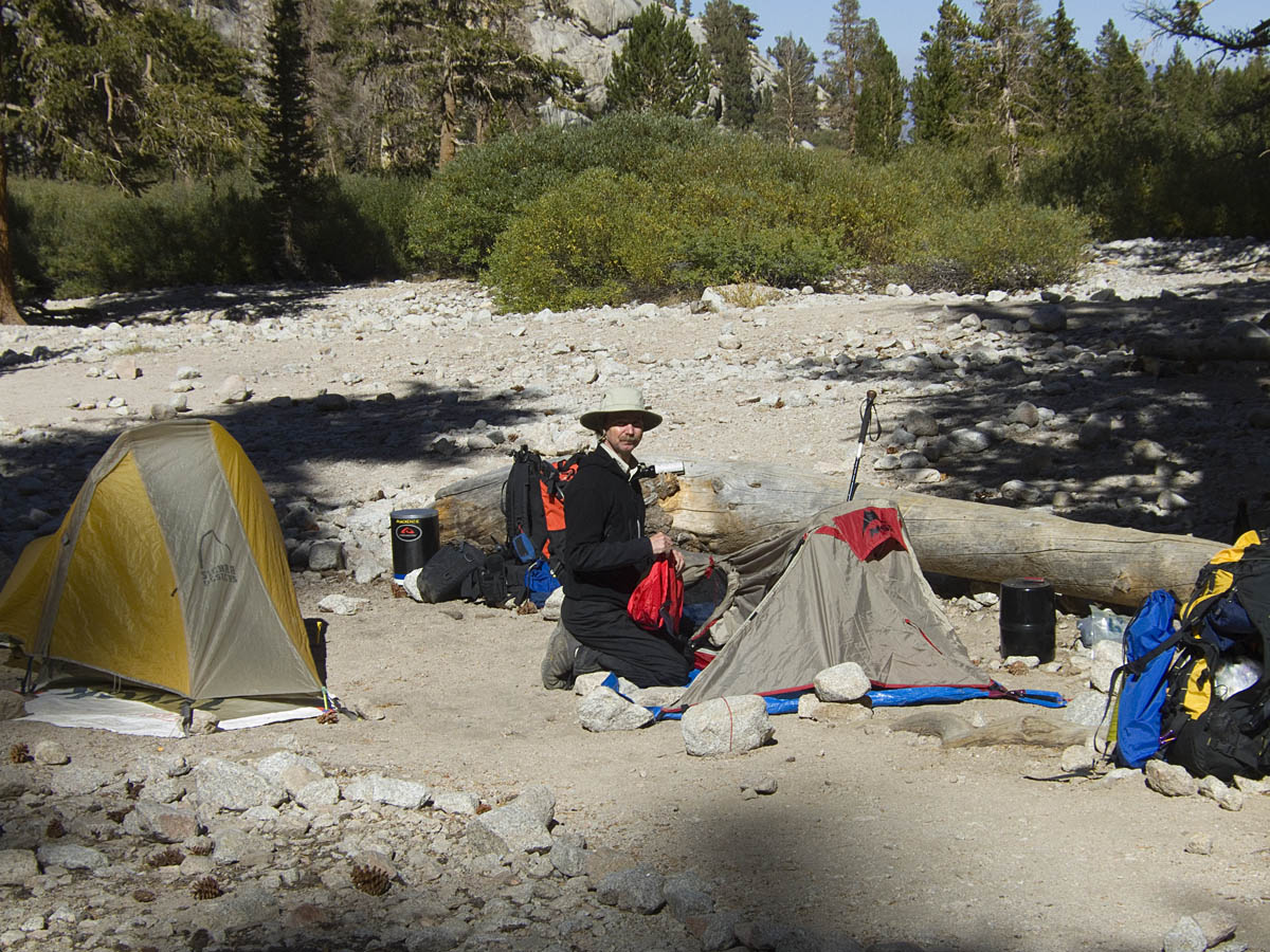
Finally, in early afternoon, we reach Trail Camp, where we'll spend the
night. There are already a good number of tents here, and pretty soon
there will lots more people looking for places.
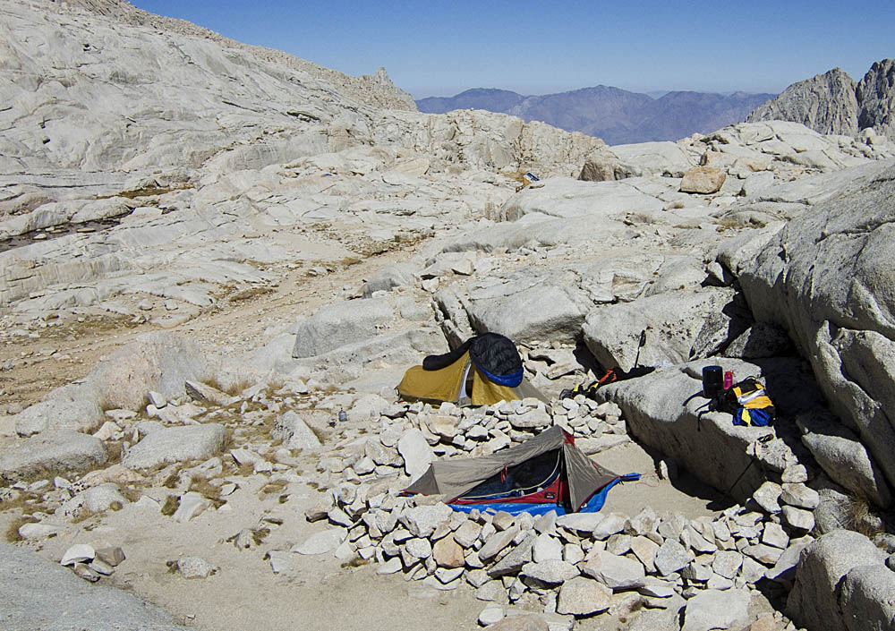
There's a small lake for pumping water, and very nice backdrop scenery.
Right now, the sun is warm and its easy to have a snooze…
The trail goes off and up to the left, over the ridgeeline and then
around the backside to Mt. Muir and Whitney, which are still out of
sight on the right.
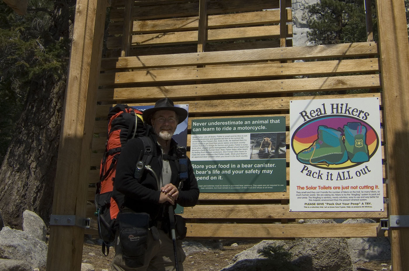
The big event at Trail Camp is the dismantling of the solar composting
toilets
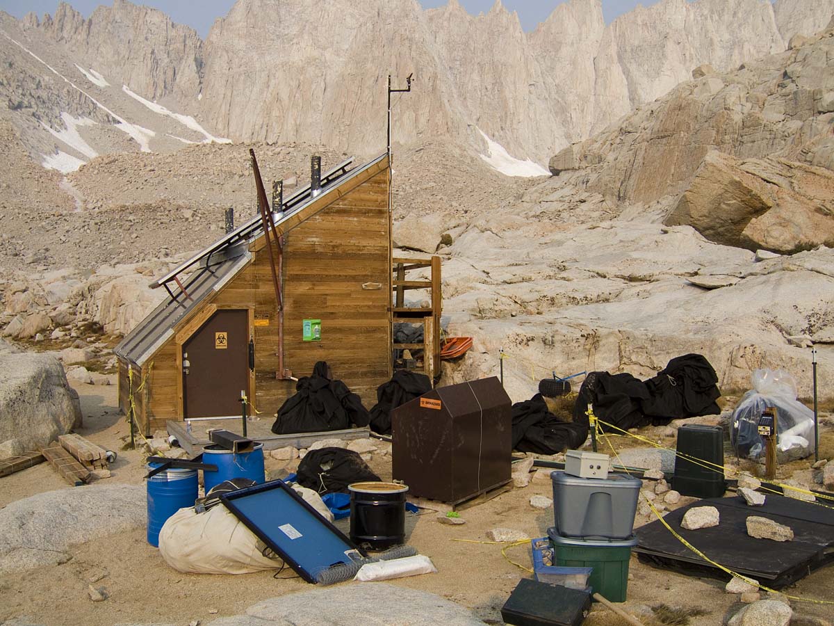
For a variety of reasons, after much lobbying from "environmentalist"
groups, they've been closed for good. The plan now is for people to
pack out all their waste in a "wag-bag", because the toilets are
overflowing. This does have merit-of course, while remembering
that because of liquid intake, your pack and wag-bag will generally
gain total weight the longer you stay out on the trail.
Interestingly, the somewhat secluded "high-ground" at Trail Camp is a
apparently a popular spot for nature calls. You don't want to be
downwind, and a stiff breeze raises the little ends of the toilet
papers like a display of Himalayan prayer flags. Meanwhile, I'm sure
some devoted enthusiasts are lurking in the bushes to nab policy
offenders. And naturally, despite the policy and a refusal to
pack-train it out from the composting toilets, the actual trails now
have a worse share of treasures secreted under assorted telltale
flat pieces of rock. Be careful where you sit.
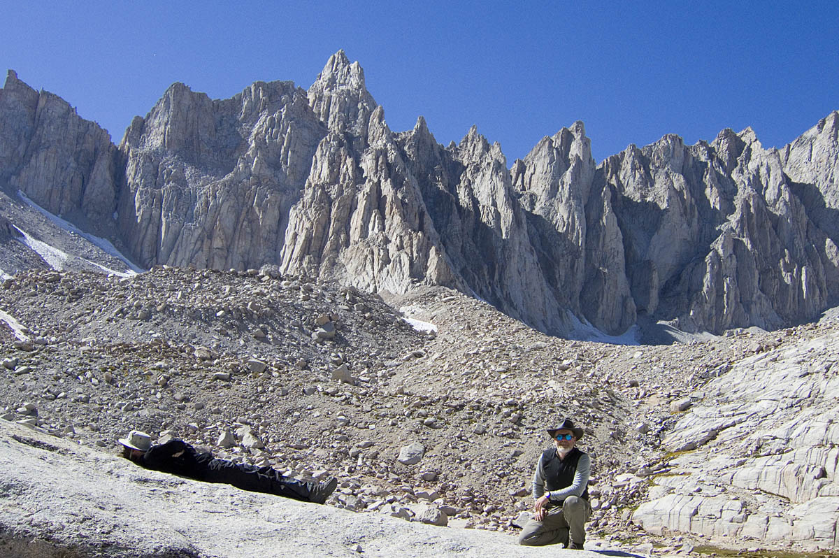
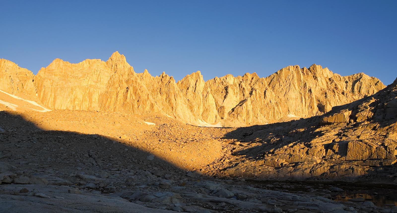
The next morning brings another fine day.
Pausing to look back, Trail Camp is at the left hand lake, and you can
just see the trail. We are now on the famous 99 switchbacks!
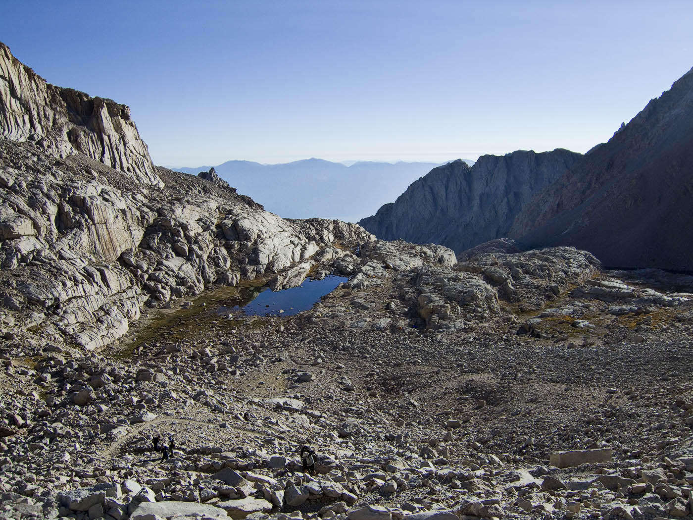
Further along, everything in the world behind you is shrinking fast.
and another 20 minutes…
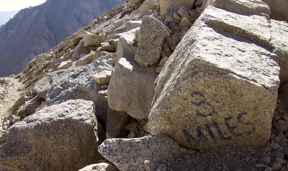
Finally, I see a marker: 3 more to go
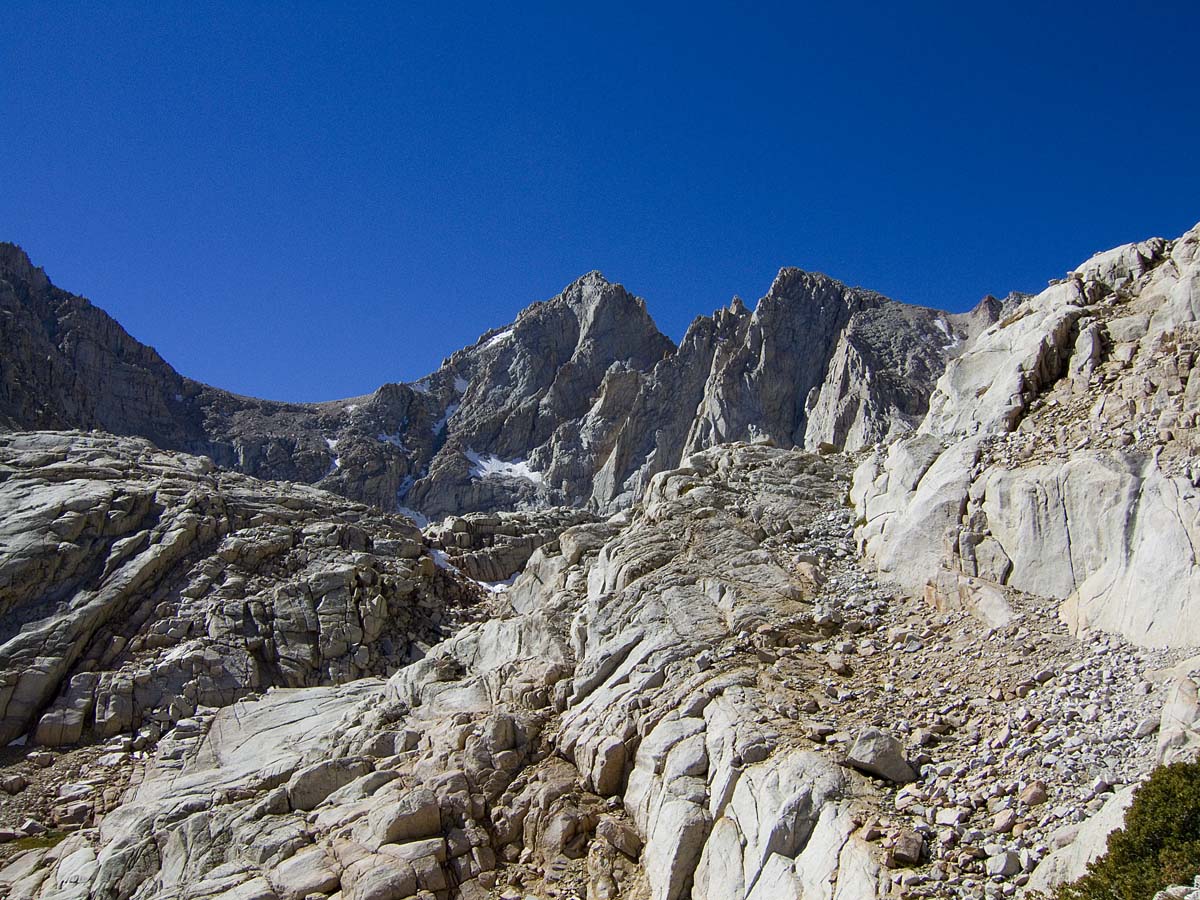
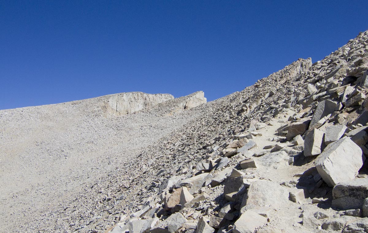
More switchbacks and at last the Trail Crest is in sight. Crossing to
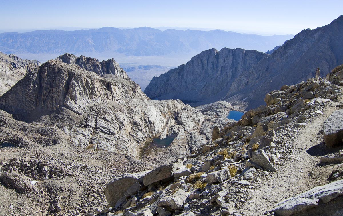
the west side of the ridgeline, a whole new vista awaits.
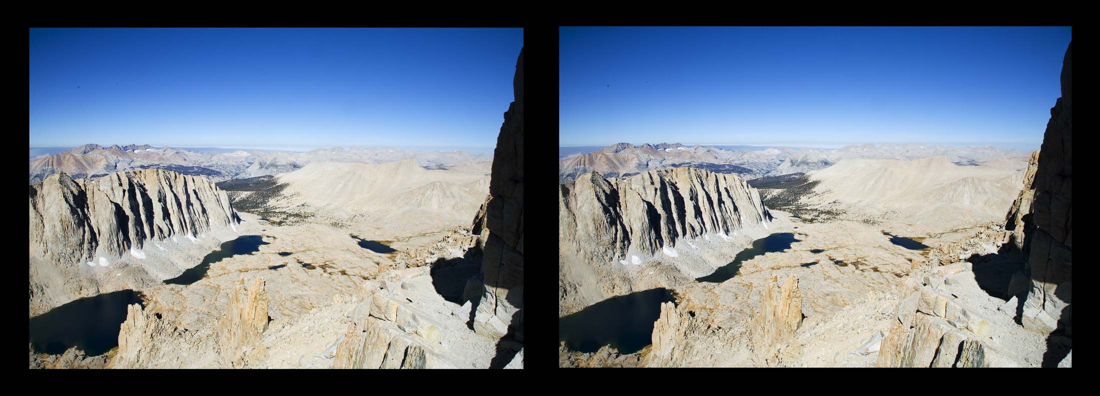
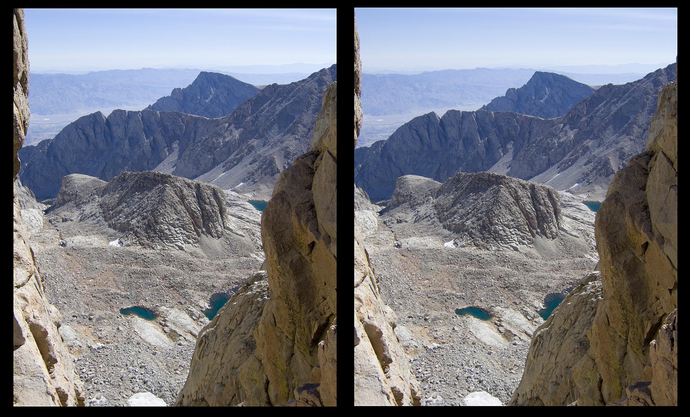
Far below, the stereo picture shows Guitar Lake to the right and
Crabtree meadow.
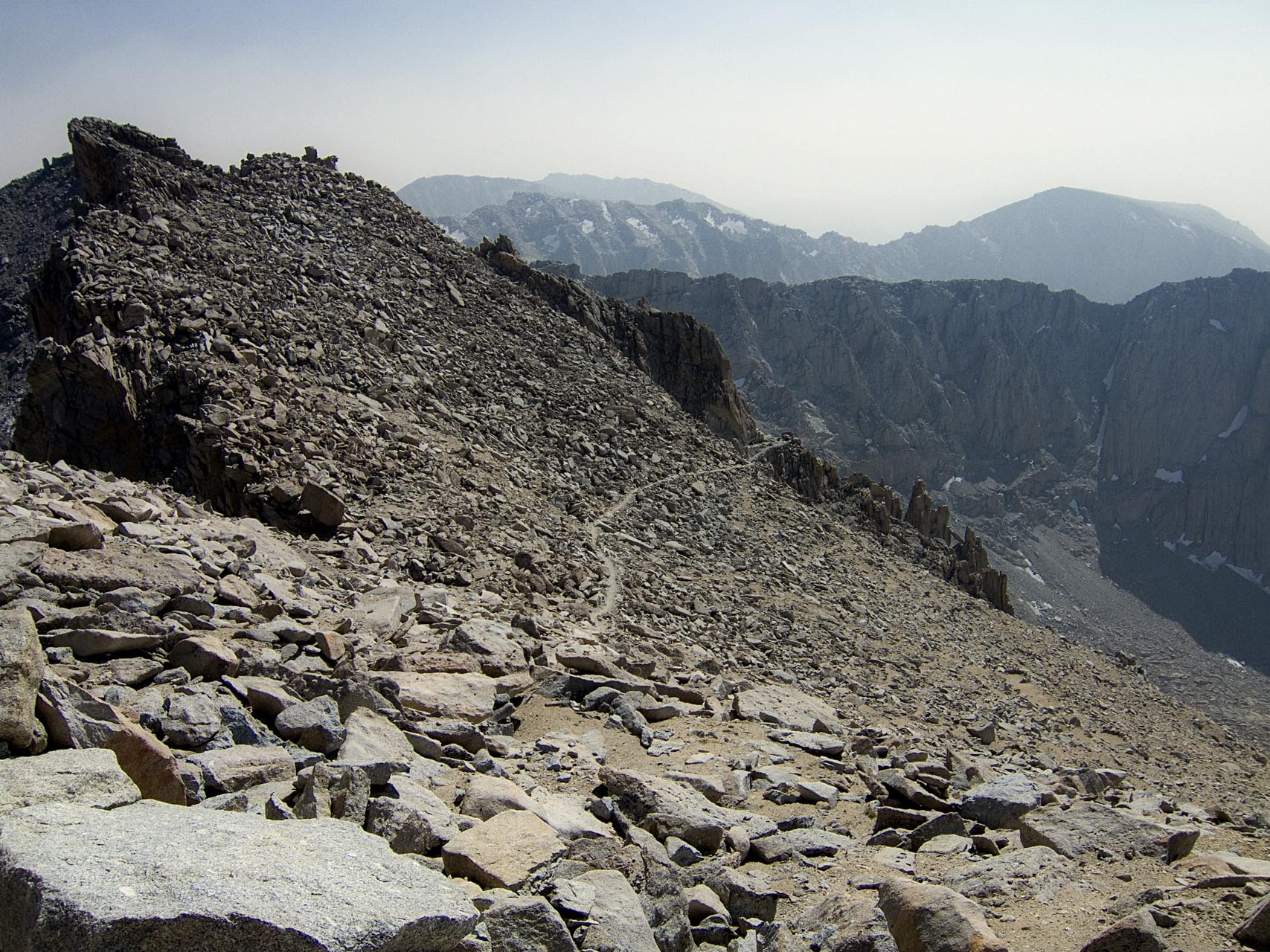
The trail gets rougher on this side, and the rocks larger. The sun is
bright and takes the chill off the breeze
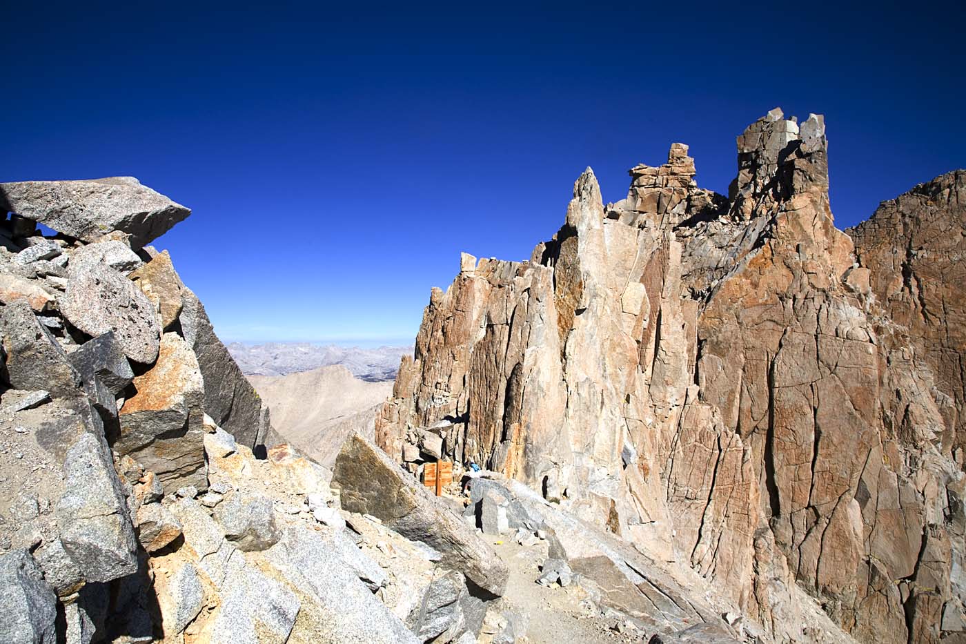
Up ahead are the Needles, through which we can look down toward
Lone Pine. Mount Whitney is the farthest peak away.
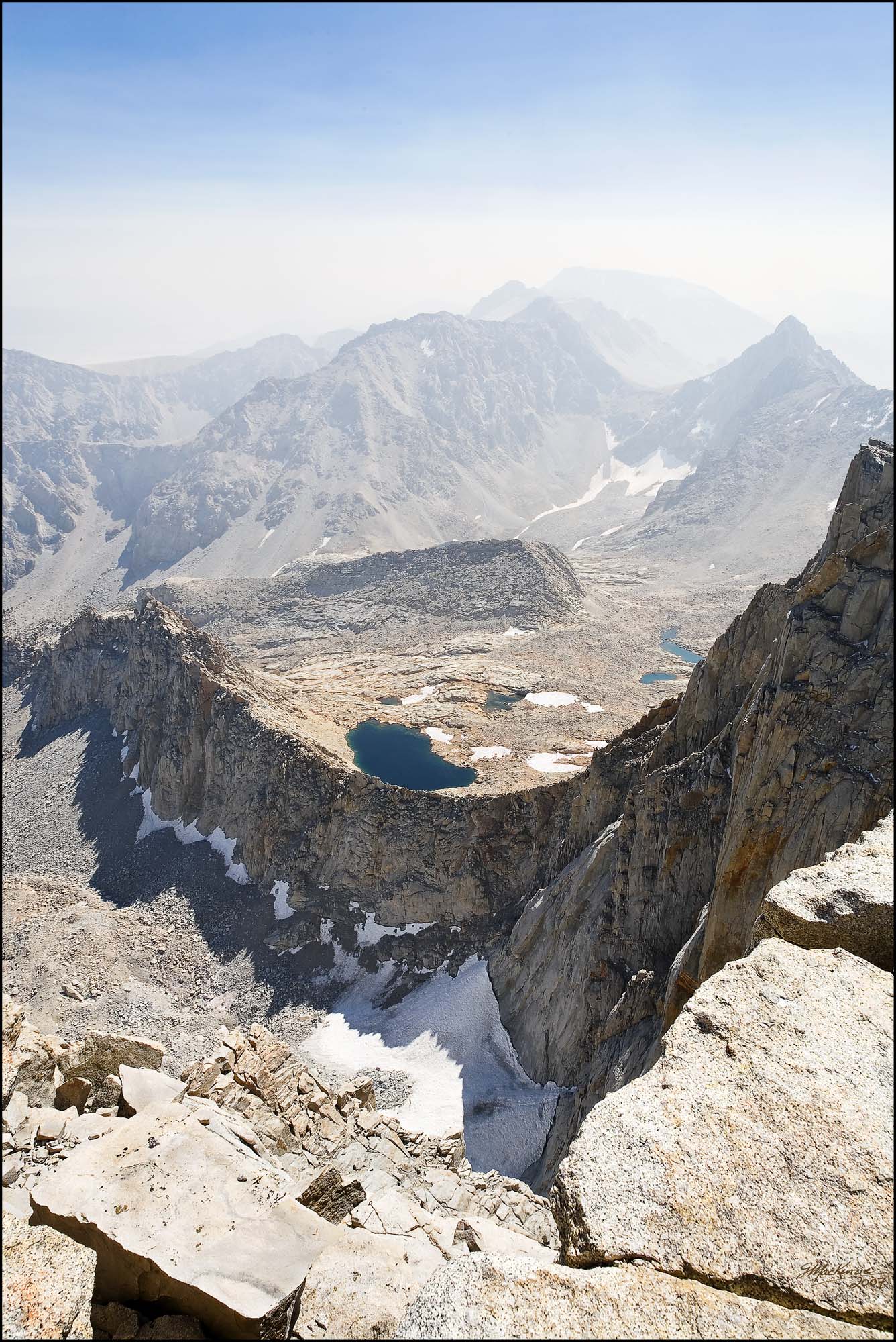
Now a first look down from the edge.
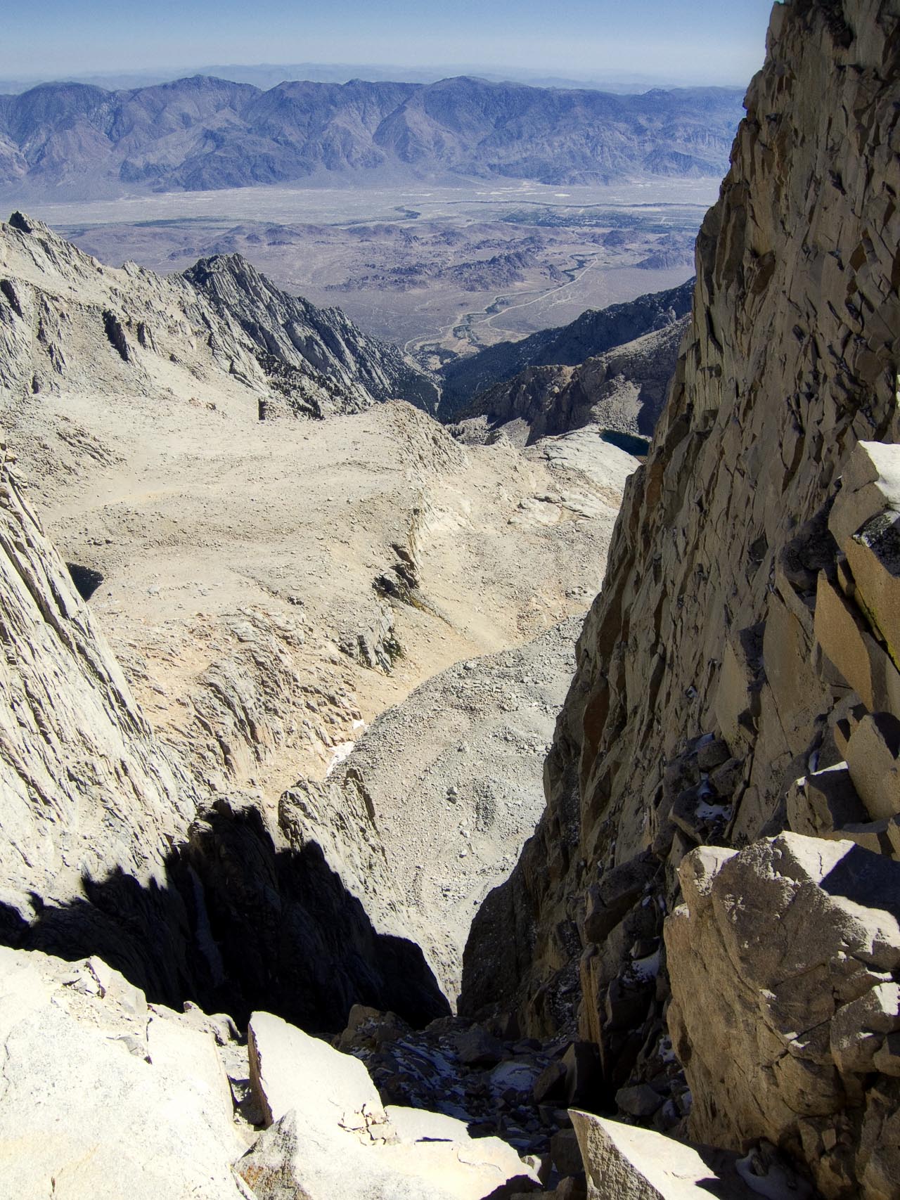
And then a stereo view through
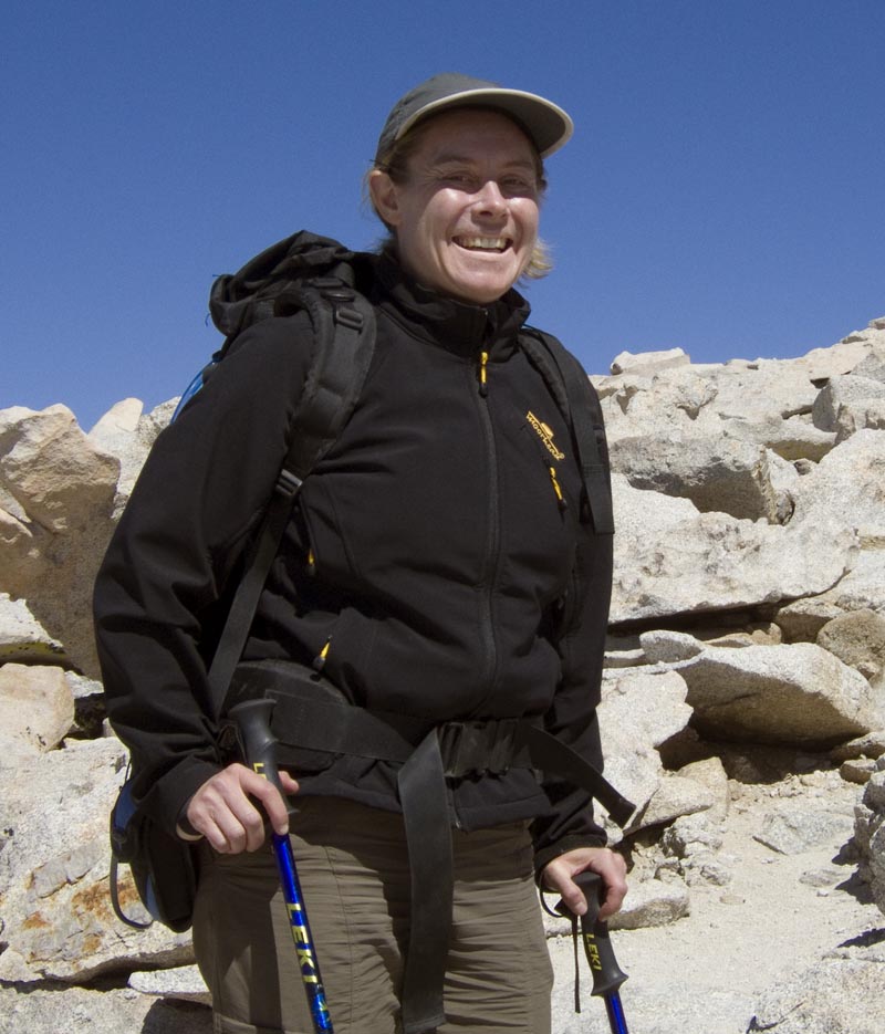
Now I'm on the final switchbacks to the top. I again met a gal who was
doing the summit today. Heike is from Germany, and had a good story.
Yesterday, their group had gone most of the way up the Mountaineer's
Route to the top, but had been turned back by dangerous winds at tricky
places. So after going back down to Whitney Portal, she set out early
this morning to go up the regular path. Now that's determination! Good
Work Heike.
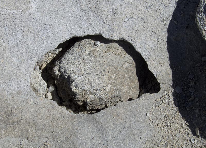
Almost at the top, all you can see is fractured rock strewn about. The
freeze thaw cycles are always at work. And yet, here is a most peculiar
formation. A cave exposed and a rock within it.
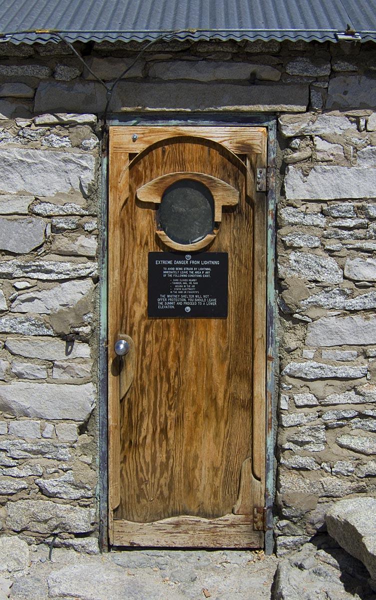
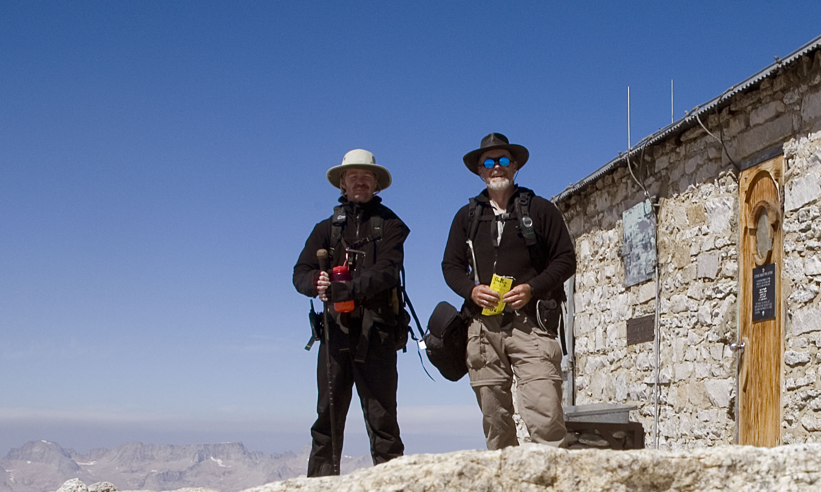
And there is the National Geographic Hut.
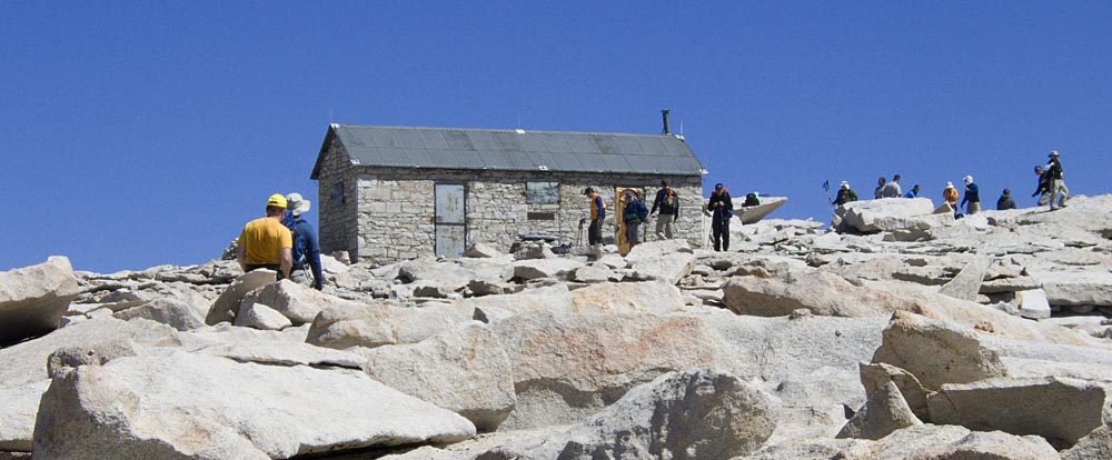
complete with emergency shelter
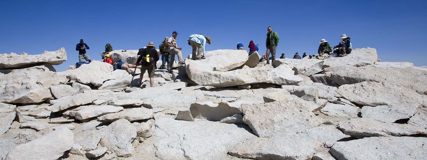
and the lunchtime crowd
Looking east from the edge
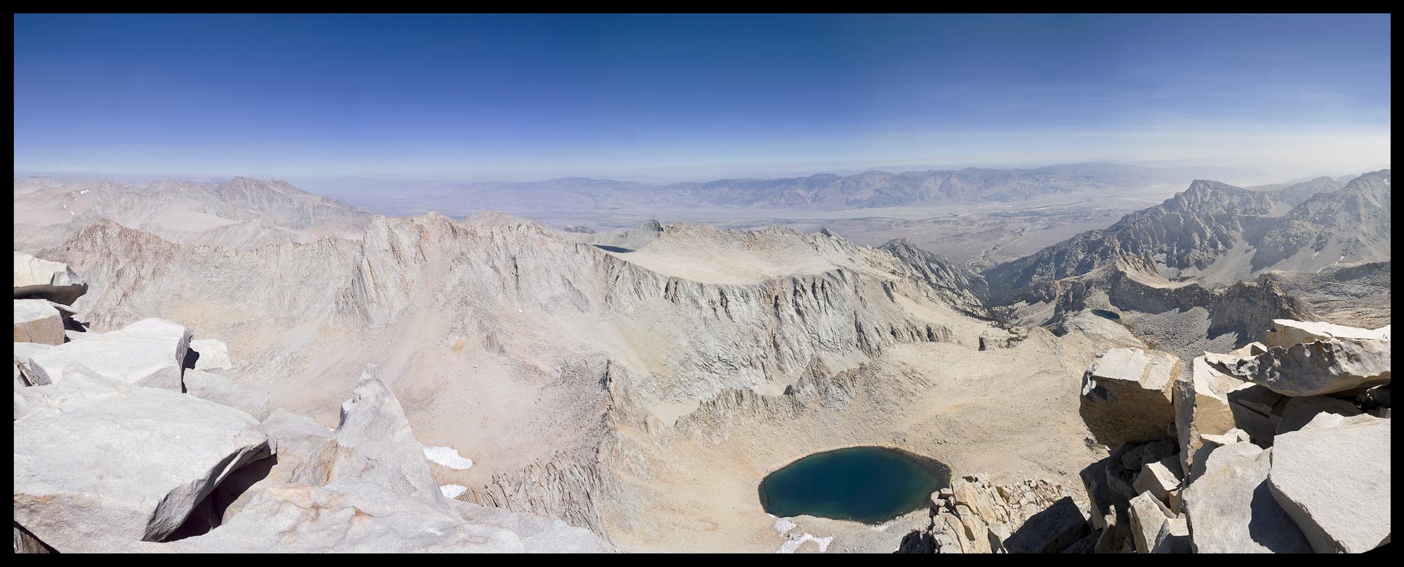
and looking back over Wotan's Throne to distant peaks
After a nice lunch, I began the trip down. Looking to the
ridgeline crossover at Trail Crest:
and eventually down to Trail Camp, to spend the night. Bit by bit
it gets closer…
…2
The next day, it's back to the Portal. Coming up on their outbound leg,
I met Mitchel and Linda who had another perfect sunny day ahead of
them. They were going to spend a night at Trail Camp as well before the
big top trip. And we agreed, it's the journey, not the destination!
Getting lower on the trail, I though this looked nice.
 .
.
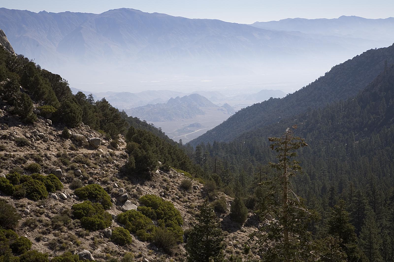
By this time, the haze from the Los Angeles fires was pretty much
filling the valleys and putting the damper on photos. So it was a
pretty quick descent, especially since I was ready to get the 57 lbs
off my back!
We were
exceptionally lucky to have had a perfect window between the heavy
winds and their dust, and then the smoke a day later. In between, the
views were fabulous. The company was great, and the people I met were
first rate adventurers from all walks of life.
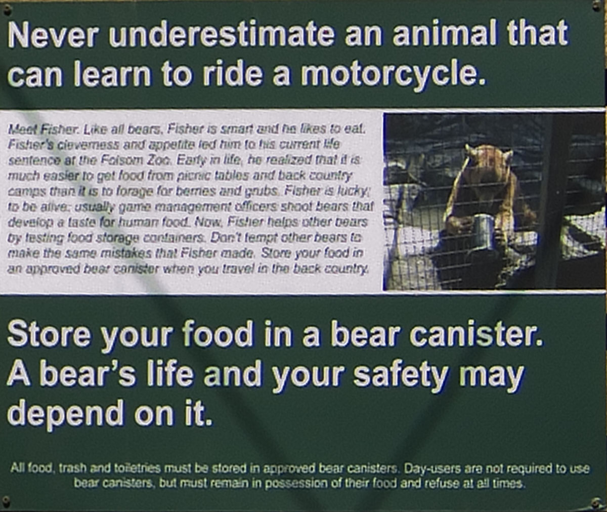
Incidentally, the picture shows Fisher the Bear.
He's a very smart convict and lives at the Folsom State Facility (Zoo)
where he's hard at work testing a bear canister.
http://www.sierrawildbear.gov/foodstorage/canisterzootest.htm
Happy Trails to all of you until next time!
gmk@diffractions.com
1.07