There are plenty of outcrops surrounded by small side canyons, and this makes for interesting explorations, and puzzles of how to get "there" from "here". It's almost never a straight line, and doing it in any line without a lot of elevation changes requires lots of walking and directional decision-making.
During the day, we ran the radio and computer on and off from the SUV. We didn't think to check the battery for proper water level and sure enough it went flat. We had a plan to boost it from our other batteries on hand, but a very friendly bunch gave us a boost before heading over and setting up camp by "Ayer's Rock".
Later in the day, the cameras came out for Golden Hour. Here are a few from that photoshoot.
Thousands of feet over the edge
Tomorrow the plan was to do the bike hike down the Lava Falls Trail to the Colorado, so it was time for a great meal of salmon cooked over the fire, and then into the tents under a full moon
.
So here we are.... But where are we again? Here's a sat map...
On the left is Vegas, on the right are the Main North and South Rim areas, and between them is Tuweep (aka Toroweap).
Although the image is in false color, there's a lot of lava there under the scrub, thanks to ancient eruptions from Vulcan's Throne.
If we zoom in, we get a nice 3-D idea of what the area holds for elevations and routes to the river. It's called the Lava Falls Trial ( I mean Trail) for a reason.
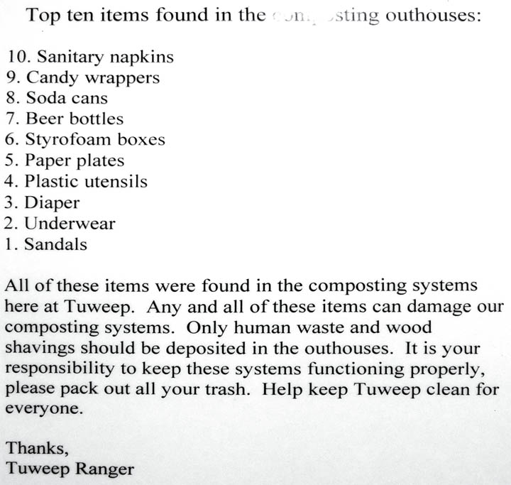
Today we relaxed around camp and took a few tours through the local geology. But first things first.