Hiking Trip September 2002
>>>Best viewed with display set to 1152 x 768 or
1600 x 1200 <<<
All images are copyright G. MacKenzie / D. Follows
2002
For some time since our last trip, my old friend David and I had been
musing about the next one, and how it could take us into the
backcountry a little bit. There is a set of programs called TOPO
which offers high
resolution (7.5 minute) topographical maps of different regions, one of
which is all of Yosemite . With this, we were easily able to scan
elevation profiles of various routes, and mileage. Some would say "just
head out and follow the trail markings"- well, if you're gonna do it
this way, better have a correct map anyway, a compass, and maybe even a
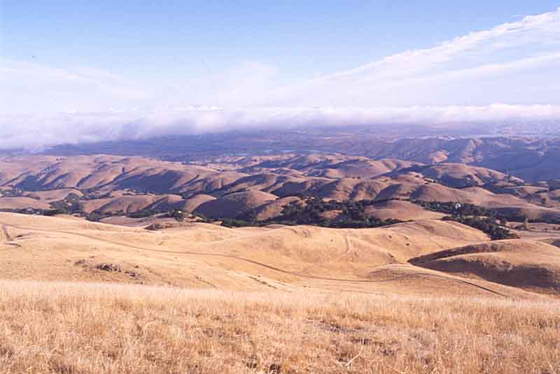
GPS. To start with though, we did a test hike up Mission Peak in
Fremont, just to stretch our legs.
Having had plenty of practice up and down the local trails out of the
Valley, we thought it would be nice to continue expanding our pathways
up and out of Little Yosemite Valley, which we camped in last time, on
the way to
Half Dome. So this time, we thought of a round trip out of the
valley
up to Cloud's Rest, north to Tenaya Lake, and then back through Sunrise
Lakes and thence to the Merced, Nevada Fall and back down to base in
Upper
Pines campground. And basically that's what we did, with a few
alterations.
We planned to be gone 3 to 5 days, depending on weather, energy level,
and my knees. We'd pump water at streams along the way, and most of the
food was freeze dried. A tarp for sleeping on instead of a tent, a bear
canister and tree ropes, a range of clothes for unpredictable weather
changes, GMRS walkie-talkies (for weather too), and hiking poles were
some of the items going with us. And of course, camera stuff.
To go to Cloud's rest, many people do it as a day hike from Tenaya
Lake-it is fairly level and not too strenuous. Heading that way from
the valley
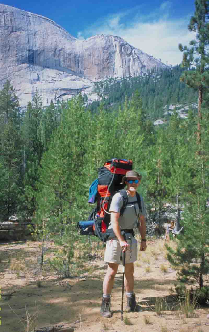
floor is good exercise to say the least. With a pack of 65 pounds, it
was
up the John Muir Trail to the top of Nevada Falls, rather than the Mist
trail like last time. Starting out early, we enjoyed a beautiful sunny
day
which was warmer than usual for late September.
By mid afternoon, we were thinking of how far to press on before
striking camp; Little Yosemite Valley backcountry campground was coming
up. We decided that since energy was still there, and we had time, we'd
get a good start on the long-Haul steady ascent toward the Half Dome
trail. Knowing that you've already got some of it behind you when
you eake up the next morning, is a great way to feel energized for the
next hiking segment!
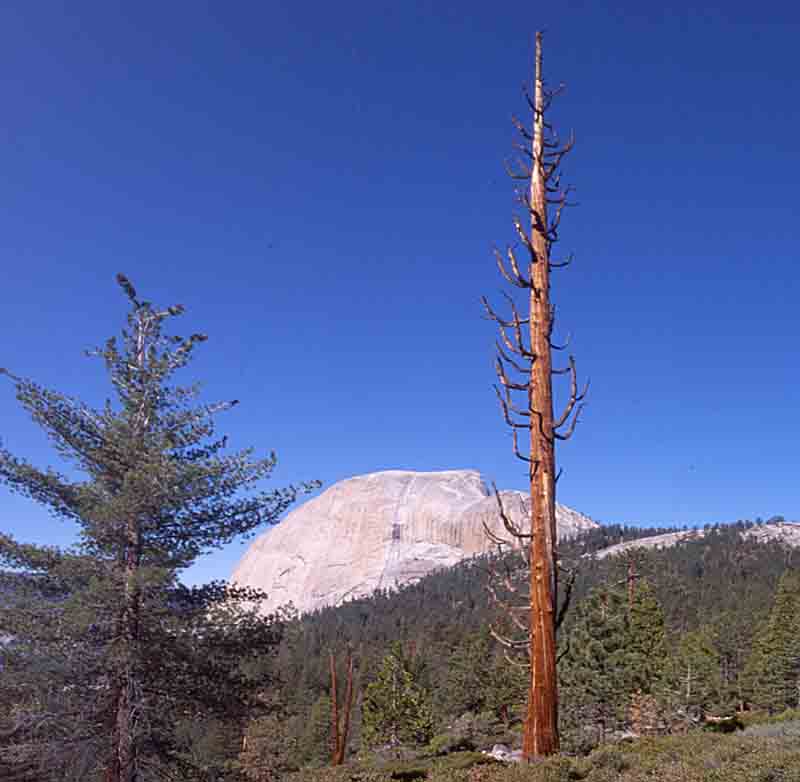
Dave and I were very glad we kept going. We got past the turnoff to
Half Dome, and were going ......along.... All along to our right was
the panorama of Little Yosemite Valley, and Liberty Cap behind us.
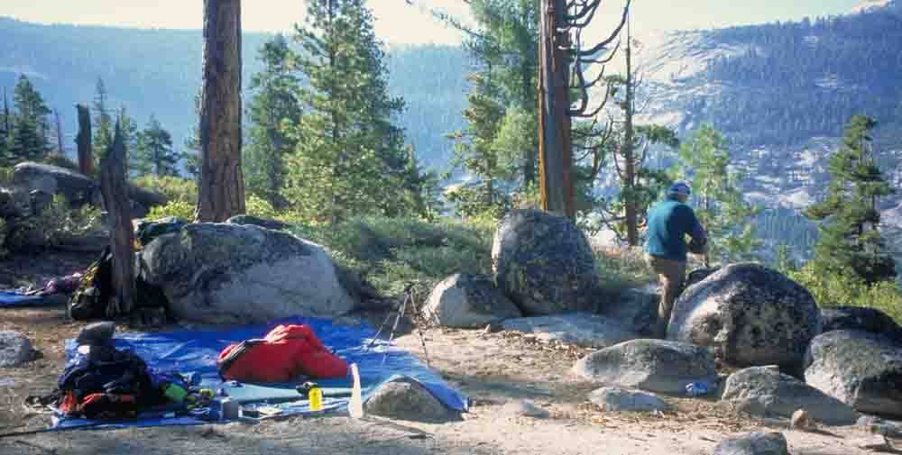
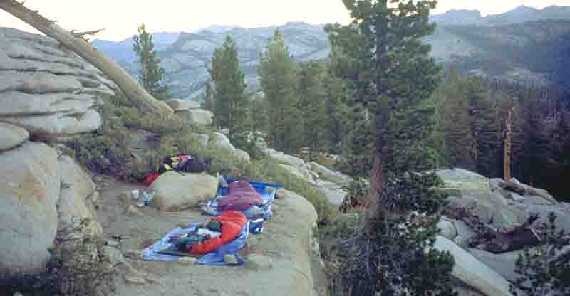
And lo and behold, perfect sites for camping, with vistas open all
along in front of us. In this 100 yard long area of small flats,
shrubs
and tress, there is ample space for several tents, separate enough that
other talking and campfires don't intrude.
A clear-sky sunrise, no clouds. Oatmeal with milk powder and
malt, and lots of hot coffee. Then on the way to Cloud's Rest. We
pumped water at .....creek and had a morning of slow and steady
climbing. Noontime had us coming round the Pinnacles, and the peak came
into clear and fairly close view. Rather than going up the closer (and
steeper) way, we went round
and came up the northern slope, complete with rock-hewn switchbacks,
reaching the top around 4 p.m. There were a couple of other
people planning to camp out; plenty of space on a flatrock along the
ridge top, or a more wind-protected ledge in case it got even breezier
than it already was. Sheltered ledge got the vote.
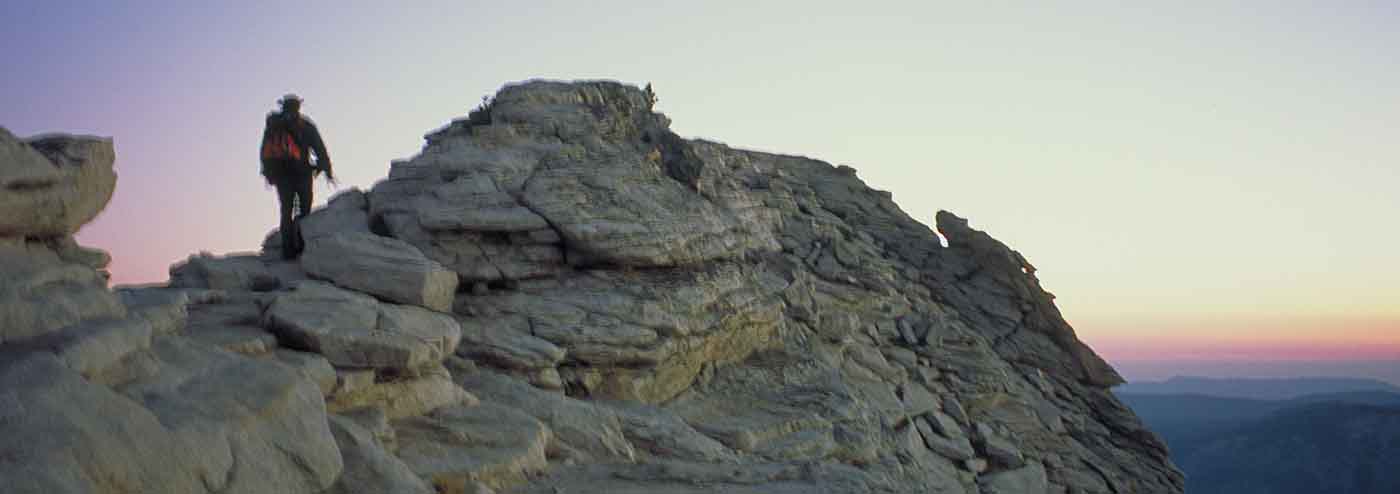
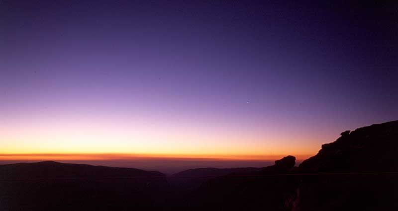
That evening I went up with headlamp to the very top, for some camera
work. Right up there just before the narrow (6' wide) ridge there was a
friendly group o six who had hiked up from near Sunrise Lakes just to
be there for sunset. By the time I headed down a bit later, they were
gone, but reappeared the next morning after an early morning hike back
up from their campsite, which we could see as a campfire speck way off
in the distance that night.
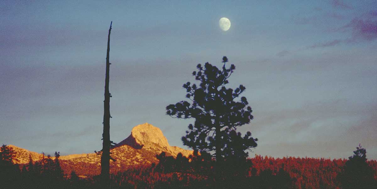
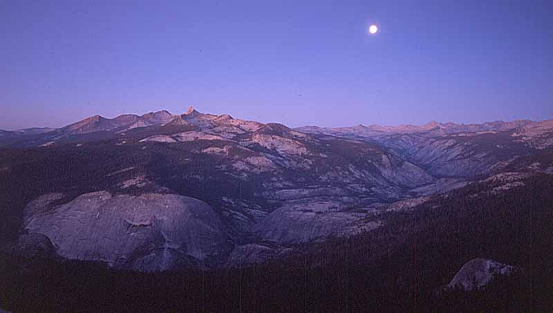
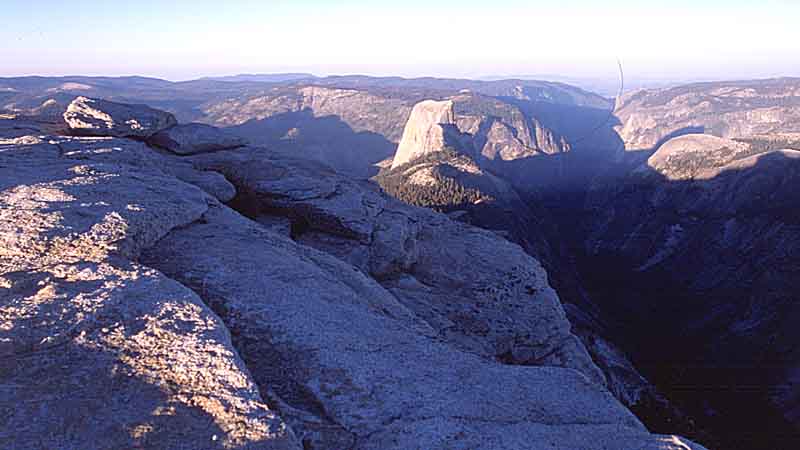
From the top, you get to look down on Half Dome, and the other way, can
see the microscopic twinking lights of cars crawling their way along
the Tioga Pass road near Olmstead Point. And a full moon to give some
ambient light.
And in the morning, past the sign and up the ridge again for a look
down of more than 100 storeys to the top of Half Dome:
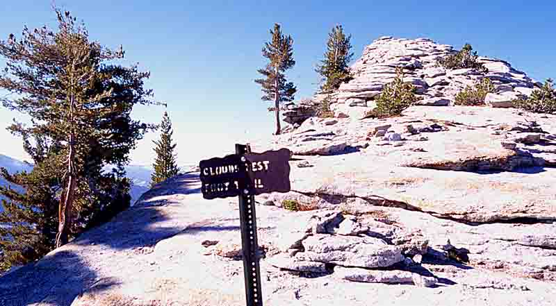
It looks sooo close
Another good breakfast, and off toward Tenaya Lake. The first part is a
pleasant downgrade, and eventually you pass through a lush low area
complete with huge talus monoliths that must have rolled for a mile to
get there.
Along here we started to meet dayhikers coming the other way from
Tenaya Lake. Being a sunny and warm day, almost all were in shorts and
light shirts, half without any pack at all, and a couple with merely
small water bottles. Good thing the weather didn't suddenly change!
Not far from Sunrise Lakes, we met a Park Ranger out on patrol and had
a good chat. We then decided to forego camping at Tenaya Lake, and
instead visit Sunrise lake directly, and then begin the loop back
toward the little valley.
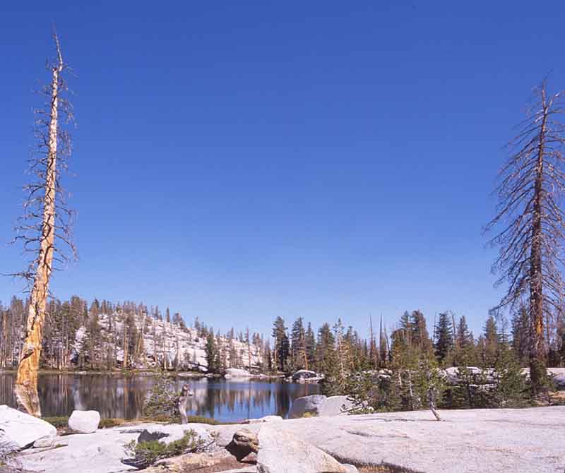
Sunrise Lakes are definitely worth a visit. The water was beautiful
and still, with no one else around. And still not a cloud in the sky.
It was around 1 pm when we started continued our loop, beginning
to generally head back. We had a steady pace, sunshine, and did
lots of water drinking. Then towards mid-afternoon, we decided that
since everything was continuing to go well, we would press on and
return to the (already
favorite) campsite where we had stayed the first night out.
Gradually
the slope increased as we headed down. Through burned out sections of
timber
we kept heading down toward Little Yosemite Valley. On and on. Down and
downer. We were doing ok although it was already a pretty full day of
constant
hiking. In the rhythm of movement, in the great outdoors.
Well, at some point before the Merced, early evening began, and slight
thoughts of food emerged. On and on. Down and Downer. Dim and dimmer.
It became the Israeli Army Training March. Keep up The Pace. Target
will be in sight soon. We both wanted to get there, and were prepared
to do what it took. Hour after hour.
Following our topo map route, we got close by the time dimmer turned
to darker. Ten more minutes and the headlights would have come out for
sure. Boy it felt good to arrive. Up and down with a 60 lb pack all day
over a range of four? thousand feet altitude, and seventeen miles cross
country. Lying down felt pretty damn good. And there was no need to be
told "Lights Out"
Coming down the next morning, we passed easily a hundred eager people
on their way up to Half Dome. The summer work on the shoulder stairs
was completed, so maybe this was pent-up demand over the previous few
days. As
it was, the weather held up beautifully for them.
On the way down from Nevada fall by way of the John Muir Trail, we
passed a couple of rangers on horseback going up-for the time of year
it was still pretty warm, and I think the Rangers were looking forward
to coller temperatures coming. The rest of the downpath was a
good final leg-stretch no
switchbacks, bring camp into view around 4. Pm. A load off the back, a
shower, laundry, and then the highlight of te eveoining-a large
Degnan's
pizza with ice cold Sierra Nevada Ale.
So after a restful day or two, we did a road trip through the Tioga
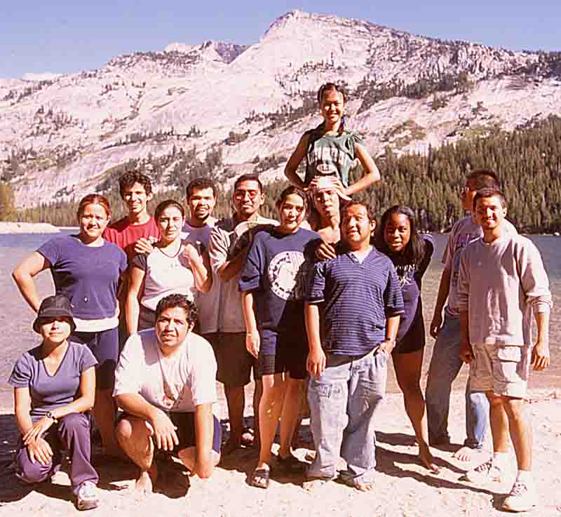
Pass to Tenaya Lake. Here we stopped again and enjoyed warm sun
and water. And so did a group of friendly visitors who asked me to take
pictures for them. After taking a picture with each of their 8 cameras,
I caught one
myself. What a great place for a picnic!
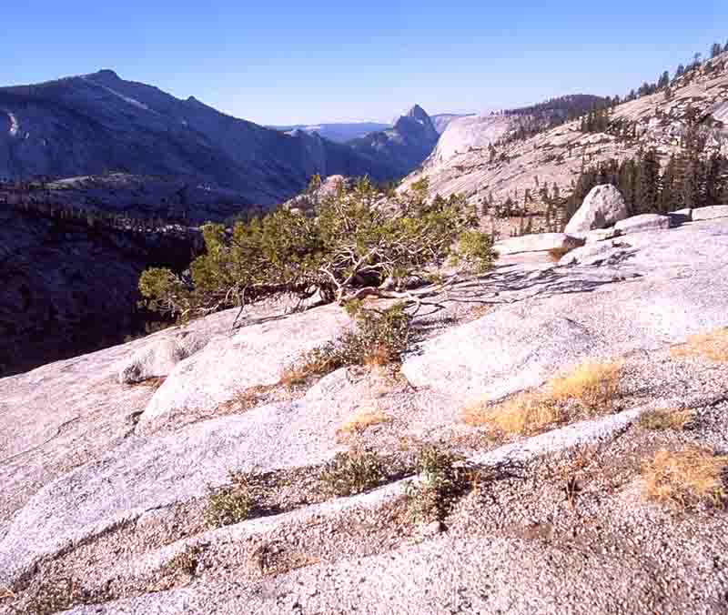
Half Dome from Olmstead Point on Tioga Road:
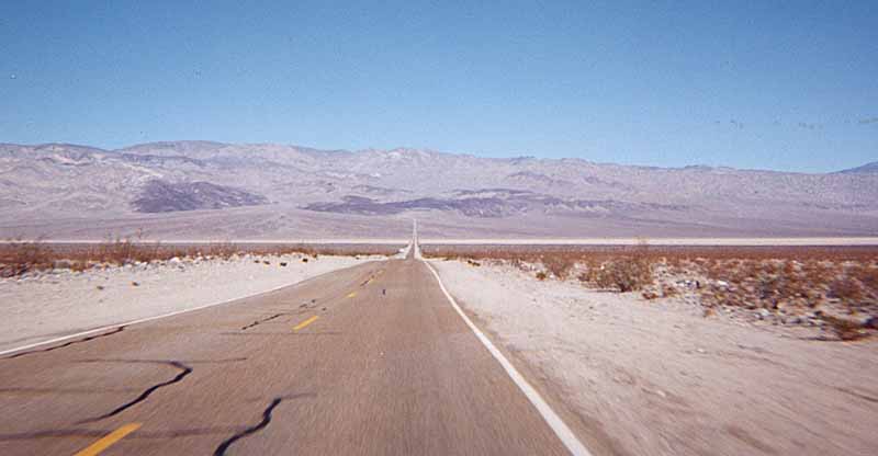
Then it was on to Mahogany Flat in Death Valley's Panamint Mountains.
Dave hadn't been here in a couple of years so it was definitely
required.
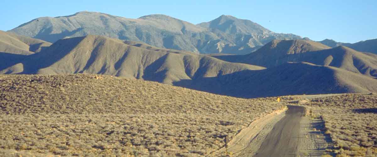
In Panamint valley getting ready to go up into the mountains...
Thirty minutes later we're closer...
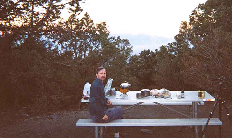
As usual, only two of the 10 campsites were busy, and it wasn't
long before the evening brought sounds gentle rolling thunder of
distant military jets out for a fly. We had a good dinne and beer -as
usual.
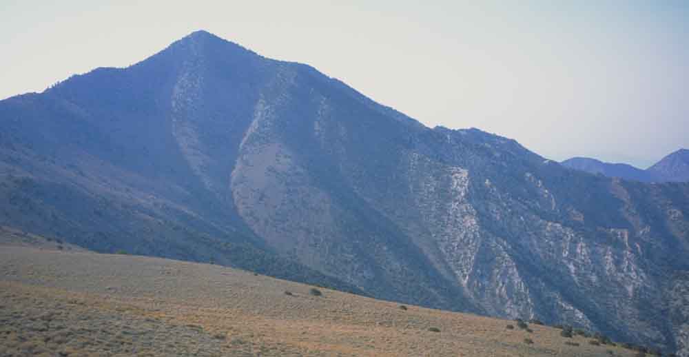
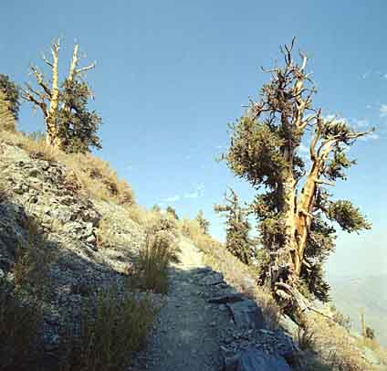
The next morning we headed out for Telescope Peak again. On this trip,
we hiked up via the service road rather than the steep trail winding
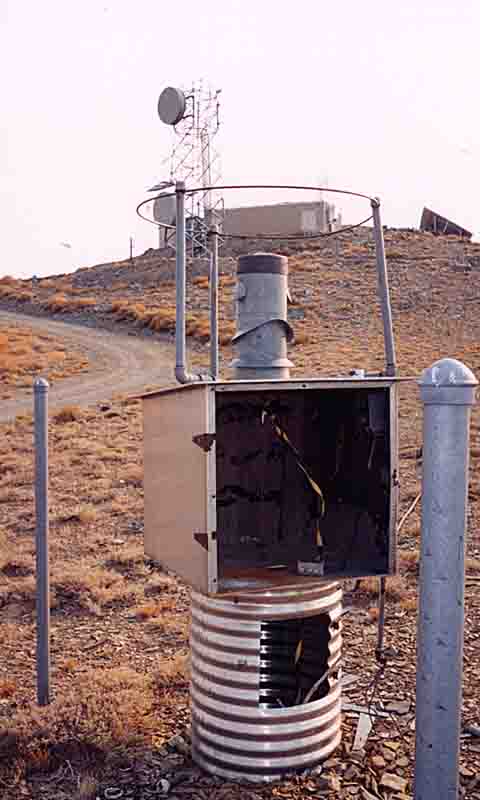
its way on the other side. We would get to the radio antenna complex,
and then go across the saddle, connecting there to the official trail.
We saw the sun full for a good part of the time, with a bit of high
thin Cirrus . Across the saddle and up into the switchbacks as
full-tilt sun
beamed down. I'd rather feel a bit warm than cold anyday.
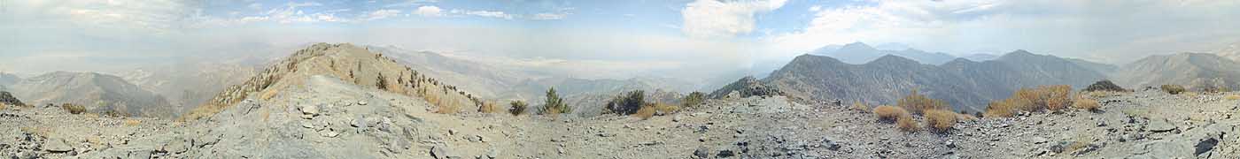
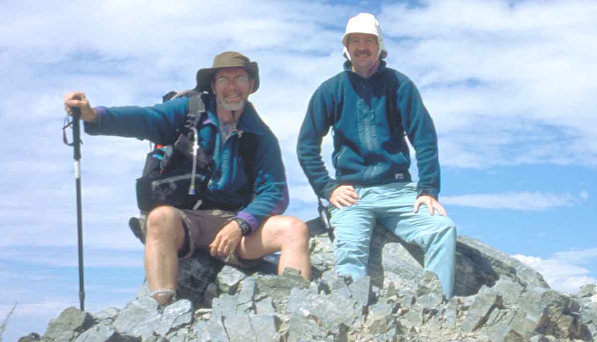
So to the top, after a pretty energetic six hours. Panoramic
view, and the white box containg logbooks of hiker's anecdotes and the
occassional donated bottle of water and chocolate bar.
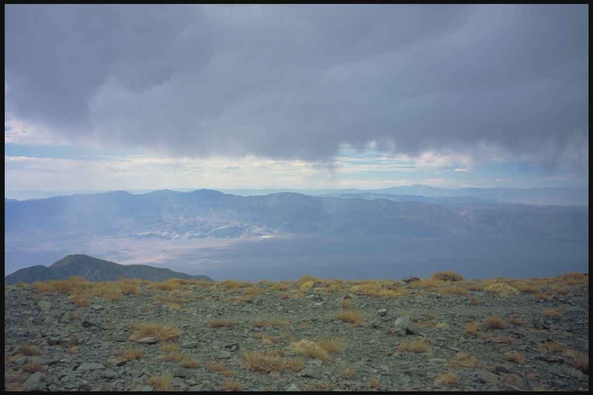
After writing a page in the book, the wind was coming up a little, and
way off down the Panamint Valley you could see a firmer tuft of cloud
developing bit by bit. In the space of twenty minutes it was clear that
the cloud
had grown and was slowly advancing our way. So of course the priority
became to get down to lower environs just in case..
It was a good thing we left when we did. The sky well behind us was
slowly filling with condensing cloud and the front starting to coming
up the valley was getting darker . .A sensble steady pace brought us
back to the saddle and starting up to the last incline when a brief
squall hit, miles up in front of the advancing darker clouds. In
the space of less than a
minute, the wind picked up from a light breeze to a steady blast that
you
immediately positioned square onto your back.
Goretex already on. Hood up. Hands in front of you as the icy
rain starts spitting and flying halfways horizontal at you, up and over
the
saddle. Brush and grasses being swept in waves, and anything loose
instantly
receding down the sadlle slope, off into the distance- by magic carpet
ride..
And then the hail. No too big, but enough to sting like hell iof it
hits your hand...so it's time to decide.. now you're at the
saddle, the coming storm looks not too good, so in case there's
lightening coming, go straight down fast along the leeward valley
toward the bottom of Death Valley..
....but wait a sec- now the hail has stopped and so has the spitting
rain And not only that, but the trundling approach of distant darker
cloud
has veered off and is clearly heading up the Panamint rather than up
and
over..and it's getting brighter-lightning is still the issue although
none
had been seen or heard.
It stopped pretty much as fast as it started. Almost like the
cloud that had encroached upward toward us was being pulled back into
the main. And soon it was decidedly less stormy., so continue along the
chosen descent rather than a beeline down into the valley.
The rest of the descent around the hill and back to Mahogany Flat was
uneventful. Before long, the sun had returned with warmth to quickly
drive out thoughts of how cold and windy it had briefly been.
For us, this was great reinforcement of why you must carry gear for
unexpected conditions. Anybody caught there with only shorts and
sweater would've
risked hypothermia even in that brief period. So windbreaking and warm
clothes even on warm days in the mountains. But more than that. We
could
have gone straight down into the Valley to avoid thunder and lightning
if
necessary. We each had two Platypuses and extra drinks and food.-enough
to make a very long winded detour of many miles , by night if
necessary.
At the start of the day, an unexpected storm, not even mentioned in the
weather
broadcast, was furthest from thought minds, except in terms of packing
and
preparation.
Good weather continued from then on. We did a big round trip down
through Trona and Ridgecrest, coming back up through Death Valley.
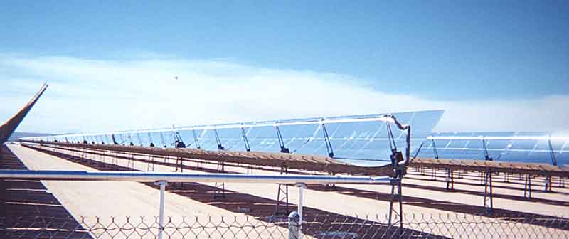
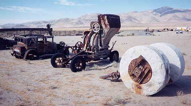
Along the way, we caught a couple of "technology" images about as
diverse as you can get, within a few miles of each other...
A Solar Power Farm stretching off into the desert
and then Fred Flintstone's roller!
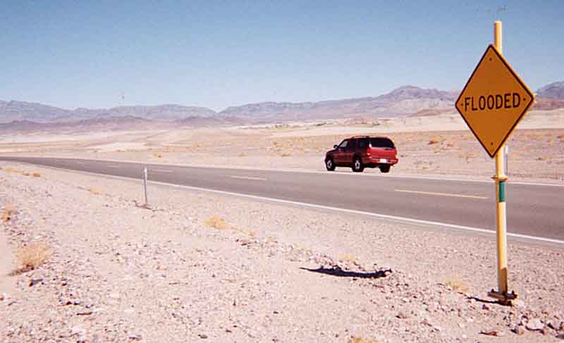
And then a surprising warning sign
A 28 mile 4 wheel drive "road" brought us in the back door to Dante's
Peak around 4 o'clock,
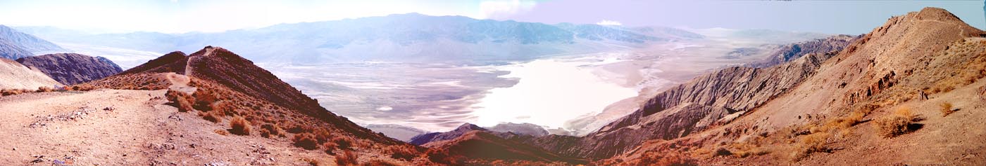
Sunny and hot. The kind of hot that bakes the winter cold out of your
bones in no time flat. And sunny, and hot. Warm enough that two
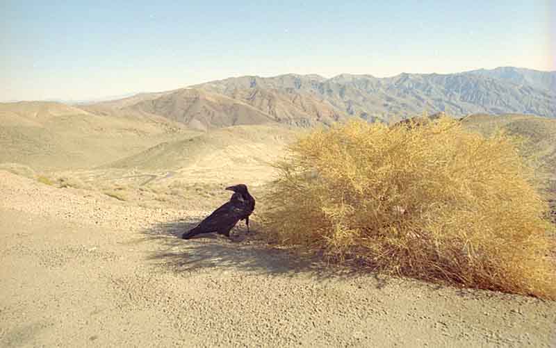
blackbirds didn't fly away, but stayed carefully and completely in
their little patch of shade from a sagebush. Being well past the high
summer temperatures, it
was only 115 degrees.
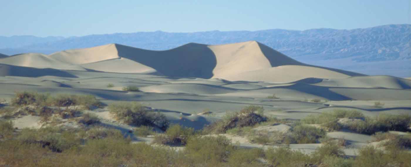
And then the great shifting sanddunes up toward Stovepipe Wells
Finally, with a couple of days let, we headed back to San Francisco,
well exercised and content. It was just a matter of days or a couple of
weeks before the unpredictable autumn weather patterns would fully
emerge. For us, it was back to Ottawa, to enjoy the fall colors
of the leaves, which, as it turned out, started late, and lasted into
November!!
All the best until next time!