Well, once again in December '00 thoughts turned to sunnier climes, and
what this year's spring runoff in the Sierra Nevada would be like. This
year though, it looked like my girlfriend Heidi might be interested in
joining me to take a nice couple of weeks to California in the spring.
Being one who enjoys travel (having not-so-long-ago spent two years on
a posting in Sri Lanka), she thought it was a great way to
do lots of camping in a new area. Of course, she was less thrilled with
the idea of 400 storey backpacking climbs out of the valley into
the mountains beyond. But you know, we started going to the gym for
workouts,
and bit by bit the general idea was less intimidating. Through the
winter
months our leg strength and conditioning improved, and we settled
on the idea of a round trip through the Sierras and Nevada, including a
week in Yosemite with a plan to get to the top of Yosemite Falls (300
storeys).
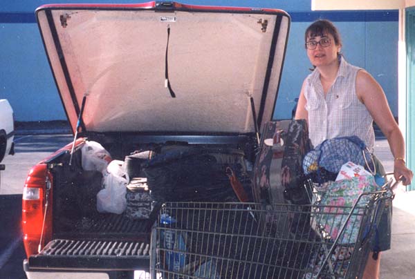
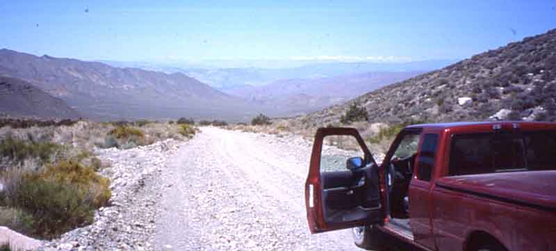
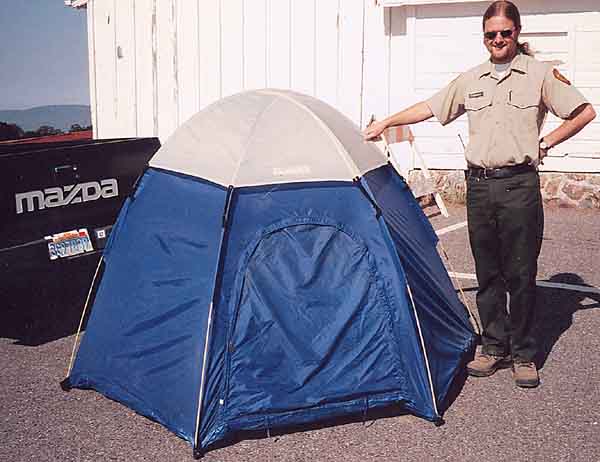
So plans were laid, and Heidi got a great deal on a pickup truck rental
from Budget-enough room for 2 people, packs etc, -and with a Vortec
V6
engine we should have enough power for the mountains, right?
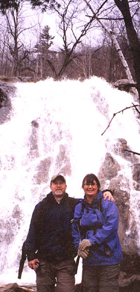
Training hike at Luskville Falls in Gatineau Park
On May 3rd, armed with 300 lbs of camping gear and photo equipment we
set out for Yosemite. California, of course is more than
Yosemite, but we had the bug and Gordon’s track record, so the
focus of this trip was definitely on this National Park. Good
thing we are both focussed and flexible. Focussed I say, because of the
weeks of vigorous training we had endured to be in shape to hike the
"extremely difficult " trails. Focussed, I also say because of
the "gruelling" schedule we’d set for ourselves. If this is
Tuesday, we must be where?
Fiiiiinally <g>, all the stuff was packed,
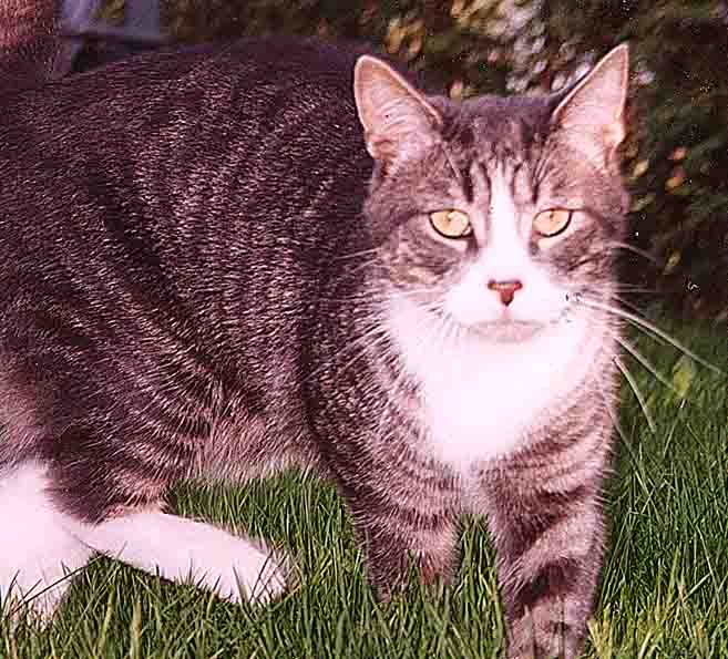
and arrangements made for house and cat-sitting. Of course,
Juniper wants to come with us!
.
Frequent-flier trips routes don't always get you there most
directly, but this one was straight through Chicago with no hitches.We
arrived in San José after a long day’s flying, wound up like
cuckoo clocks we neede to head for the stores. There are certain
things which we could either not fit into our bags, or could not
legally take on an airplane...camping gas, styrofoam cooler, ice,
sushi..
.
So we picked up the truck, and the first segue onto 101 out of
the airport got me thinking about Ford Rangers. Just merging
took the engine well up intro the three thou' range-what in heaven's
name
would 15 mile steady ramps into the mountains be like-and how big was
the
gas tank in this thing anyway? But hell, what a great deal, and a
chance
to try something different!
After supplies at REI and Safeway ( an old discount card and phone
number still works each year even after five years gone from San
Francisco), we spent the night at the famous Fremont Motel
6 and the next morning headed out of Dodge.
On May 4th the saga really begins. We headed north,
did a quick tour of San Francisco, went over the Golden Gate
Bridge, paused at Treasure Island, took a few pictures of
Alcatraz
out over the Bay, and took our picnic lunch to the Marin (pronounced
muh-Rinn)
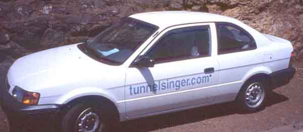
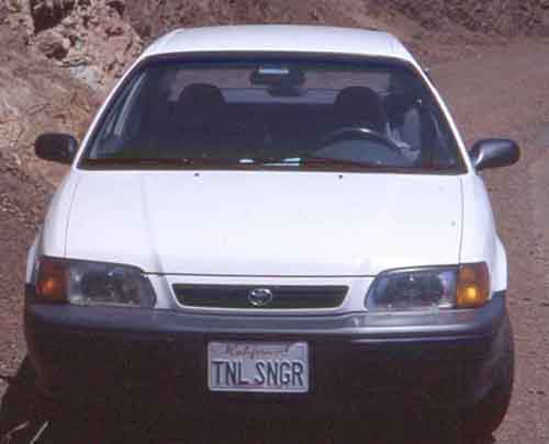
Headlands and met up with the tunnel singer. Now what on earth
is a tunnelsinger.com? Check her out! Lee Ellen walks the
tunnels in Northern California and likes to listen to the echoes made
by her voice resonating against the round walls. Think of a huge
outdoor
cathedral sound.
After a pleasant time listening and exploring there was no time to
spare. We then buzzed along the winding roads to visit the Muir Woods
where the trees are 800 years old, and without a minute to spare headed
over to the Sonoma valley to camp.
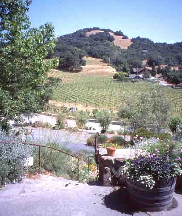
The next day (May 5th) was devoted to the Sonoma Valley. We
toured the Ravenshead Winery,
then found a delightful little thrift store called the
Churchmouse and visited the most northern of the Spanish Missions at
Sonoma. Then off to Sacramento, where we saw the railway museum
and toured what is a relatively quiet town.
May 6th – We left Sacramento much too late, and spent quite a bit of
time having a key cut so we wouldn’t lock ourselves out of the rental
truck in the middle of nowhere. A few hours of San Joachin valley
driving brought us to the western foothills
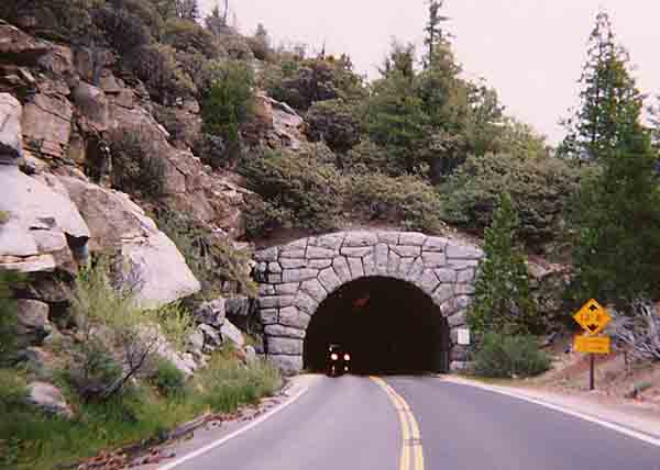
And soon through the tunnel taking us officially into the
Valley. Despite the extra distance, we took the second entrance
so that we could enter at the exactly picture perfect spot.
This tunnel exists for the sole purpose of connecting Yosemite.
Coming out of it into the valley, I was suitably impressed.
.
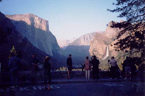
The next day (May 7th) was a perfect day for a warm-up
hike and so we headed for Vernal Falls via the Grand staircase on the
Mist trail. Considered a "moderate" climb, it is wheelchair
accessible at the very bottom and lots of people attempt the first
quarter –at the top of which incidentally is the last place there
are actual rest rooms.
The climb to Vernal Falls was spectacular, but not what
I would call moderate. It is true that there are stairways carved
in the stone, but these are steep and winding. There are many
areas where the mist from the falls feels more like rain, and it is
cold even though the sun is beaming. Many people turn around when
the trek
gets difficult, and we met one woman almost in tears where she had
decided
to quit and wait there for her husband, who had left her behind.
Gordon tried to persuade her to come with us, but despite best
efforts,
she wasn't convinced that our company would make it ok.
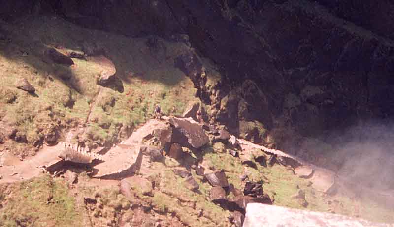
Just before the top of the falls there is a very narrow walkway
carved along the cliff edge. I clenched my jaw, said a quick
prayer, and followed my guide. In the back of my head I kept
convincing myself that they wouldn’t allow us there if it wasn’t safe.
On the one hand, don’t people sue over stuff like this...but on the
other
hand, maybe it's all about taking personal responsibilty for activity
with risks...
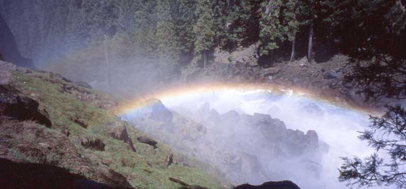
After dinner, we took in the full moon and we followed the other
tourists to see a moonlight rainbow on the Merced river. What
good fortune to be there at the perfect time.
It was time for some laziness. This was the in-between
day where we gathered our energy for the big climb. We drove out to
the Mariposa Grove and wandered amidst the thousand year old
forest.
In the interest of conserving energy we boarded the tourist bus which
took us around the grove and our driver/tourguide gave us a great
history
of the trees. Several had been planted recently to replace those
which inevitably will die in the next centuries. Early last
century
people actually camped around the trees, and drove their cars and
horses
on and through the fallen ones.
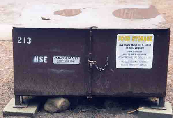
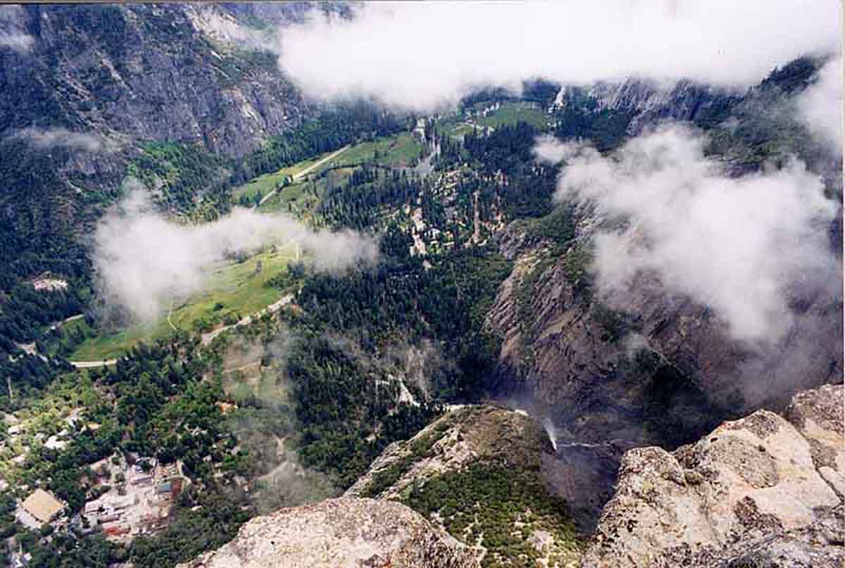
Early morning of May 9th...the grand day for the big climb had
arrived. Because the sun is late getting into the valley, it
is quite dark starting out with a plan to be on the trail at 6 a.m.
(This way, you get well up the slope before the sun can start beating
straight at you on the first leg to Columbia Rock). Everything
food-wise
and scented went into the locker first though...
By 7:30 we were on the trail. It wound and wound and wound and
went up and up and up. We kept going and going and going.
At times it was necessary to go down in order to go up. It was
hot. It was sunny. We had the necessary hydration packs,
ropes,
cameras, tripod, food, bear bells, emergency supplies, t.p. and shovel.
Approaching Middle Cascade, the Valley is getting ready for a day of
sunbeams. 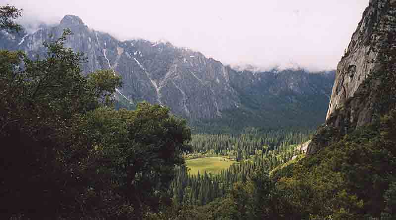
It was around 10:30 that we hit the switchbacks up the talus to the
top, so it was still relatively cool and only heated up to the bearable
level for the last little bit. If you leave the valley later in
the morning, you hit this section past midday, just when "Yellow Face"
is shining straight down onto you and all the bare rock around. Think
of not much wind, and walking through a warm kiln, and that should be
enough encouragement to get you up and onto the trail early enough to
avoid being caught there.
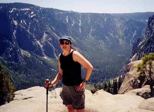
At a good steady pace, we made it to the top in good time.
With many stops for pictures and victuals we reached the top of the
falls by about 1:00, in time to make a couple of phone calls home to
those
poor people stuck at their desks. We took many pictures and time
to relax. Gordon had thoughts of going one further kilometre to
Yosemite Point, but by then my legs and courage were spent and I
refused
to go further. We did it, it’s grand and it’s enough for today!!!
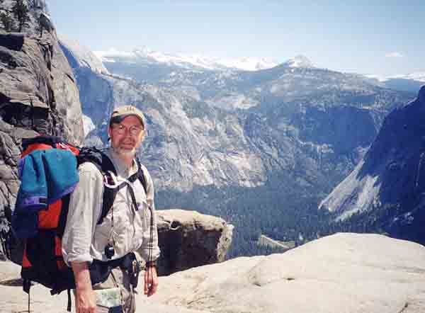
And we had a great lunch, even though Heidi's special gorp had been
fast depleted by me on the way up.
Surprisingly, there weren't that many people there, especially at such
a wonderful time of year. Coming down later in the day, we
still didn't see many people, even up to the Middle Cascade!
One may think that going down will be a breeze, but in fact it is
sometimes more difficult, in part because of fatigue, and in part
because of the stress on one’s knees. There are at least sixty
switchbacks because of the grade and of course in reverse, it is
necessary
to go up to go down. We made it back to the truck by 7:30
pm.
A full circle on the old clock.
.
Sadly we left Yosemite Village the morning of the 10th. There was
still so much to do, and so much to see, even after that day of
scenic touring , including cougar tracks well past Forrester on
the dirt road. But we set out for Sequoia National Park and the big
trees.
Well, it was a wonder that that little Red Ranger didn't
explode. Even with a its V6 engine, it couldn't help going to the
redline regularly, just to keep up 55 mpg with the other traffic
through
the steep mountain roads. You couldn't put it in a lower gear for
fear of generating a long line of angry traffic behind, so it spent
the day frequently downshifting, then up, back and forth back and
forth.
What ever you do, remember this when you're choosing a vehicle for
Sierras travel.
The better part of a day's driving brought us to Sequoia/Kings canyon,
and a change in the trees, as a result of being a bit further south,
at higher elevation. There was snow at Lodgepole
campground. Sleep came easily, but not until we supped on BBQ’d
steaks and chocolate pudding. Thank goodness the days were warmer than
the nights.
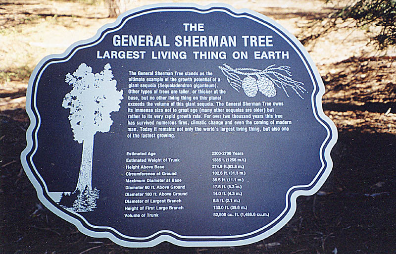
The General Sherman tree and its relatives made quite an
impression on Heidi.
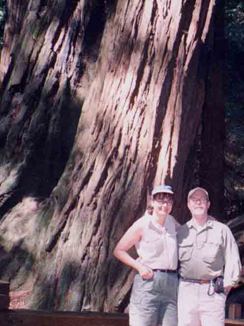
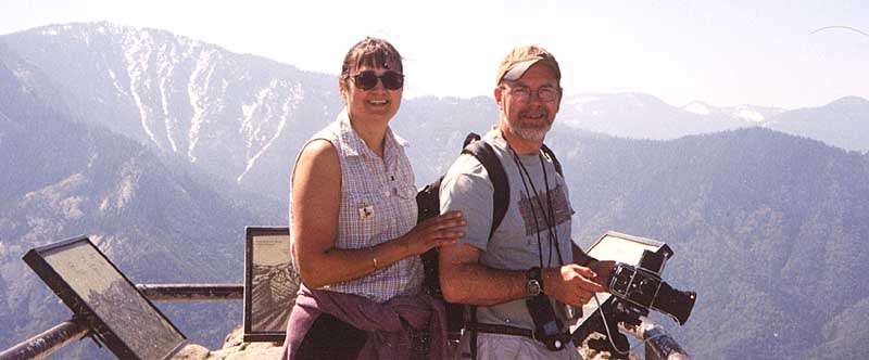
And the view from Moro Rock was great
A chilly night at the Lodgepole campground, and we were on
the way to the desert by serpentine descent into the San Joaquin Valley
where I saw my first Yucca trees. We bought cherries on the side
of the road for $1 a pint and drove merrily along spitting the pits out
the window. (Well, at least I did.) The long drive took us
south and back eastward through the Mojave desert (briefly), where I
got a quick glimpse of an airplane parking lot & a quick natural
history
lesson at the visitor’s information centre. And then northward.
Mahogany Flats seemed a very long way to go to camp for the
night.
Why couldn’t we simply stop at Stovepipe Wells in Death Valley? I
had no idea of course, what Mahogany Flats was at that time, and the
spectacular
climb that was awaiting us.
If I had to describe the single most thing which impressed me about
this California trip, it was the climb up to Mahogany flats.
Death Valley is known for being at sea level, and for harbouring the
lowest place on earth, some 350 feet below. To get to Mahogany
flats one must cross two tree lines. At the absolute bottom it is
too hot
and dry for anything but a few cacti and sagebrush, but as we start
climbing, the temperature drops and there are quite respectable trees
and forest. Mahogany is at about 8000 feet elevation and above
the second tree line. It is possible to see the Panamint
Mountains and for miles and miles. The road is almost verticle
there and the camping is free at MF.
we left some spare t.p. in the facilities. Without a 7-11 for
possibly hundreds of miles, it would be a terrible place to run out of
t.p. I think we dined on salmon fillets that night, with
ginger. It was glorious.
The Little Engine That Could actually made it. Ford should be
proud. 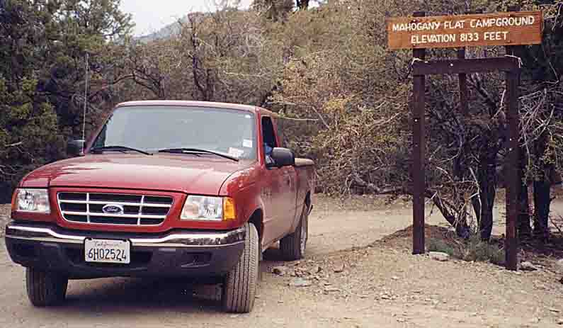
Perfect weather. Perfect views. With just the occasional evening sound
of jets from Edwards and China Lake streaking down Panamint
valley- the drawn out rumbling sound of them reverberating into the
mountains even though they were tens of miles away
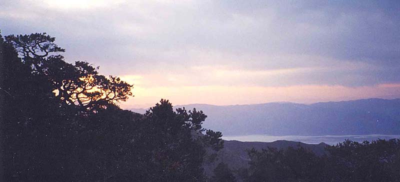
Well, it would have been nice to stay, but there was so much
to see. We came down from the flats, with a stop to take several
pictures of the charcoal kilns which were left there from the silver
mining
days. We drove around the Rainbow Canyon (36 21.502N, 117
34.472W),
visited Panamint Springs (a misnomer) then off to Darwin. The
desert
looks mean though,with only the occasional Joshua tree, and probably
crawling with rattlers. Luckily, there were no live rattler
encounters
today.
Darwin, complete with dance Hall and Post office.
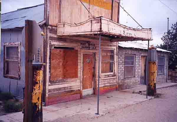
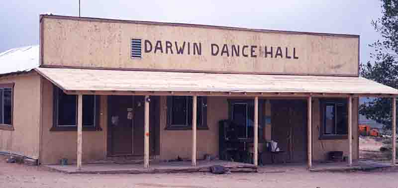
There are still a number of people living here. But not so at
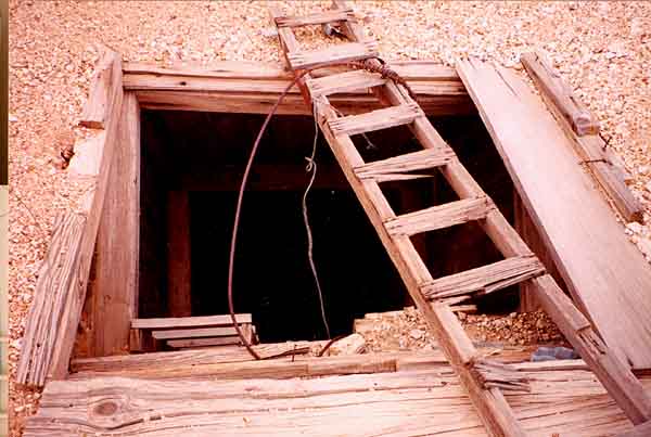
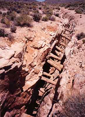
Skidoo, which is a10 mile rough road detour in the Panamints.
I think Skidoo has one of the highest densities of open
mineshafts in the entire southwest. To think that men dug these shafts
by hand,
some of them being 300 feet deep. And now they sit amidst the utter
silence of bygone days, until reading the local history and walking
there brings them alive with activity again.
We stopped at Stovepipe Wells for gas, right in the middle of a dust
storm. With the truck door open, a big gust of wind wrapped
itself around Gordon’s sentimental map of California and took it
dwinding into the distance across the desert. I gave chase for a
while, only to turn around when my sense told me that I was probably in
heavily populated snake country. I felt terribly guilty that the
map had gone, it made a good story, but that map meant a lot to Gordon,
and I was sorry. But wait, why am I telling this
story? Lo and behold, when we left the gas station, way down the
road there was a Tourist Information Centre. New map, you
say? No indeed: the wind had taken the sentimental map down
all that way and it had wrapped itself around a fencepost.
All’s well that ends well. We retrieved the map and headed to
Vegas
for a night on the town.
Vegas is a lot of glitter, noise and people. Naturally, I had to
see the Pink Flamingo, and so that was a natural spot for dinner.
Money was burning my pockets and I had to try my hand at the one armed
bandits. Being the cautious type, I sprung for a quarter.
Well, bingo. With that 25 cent piece I kept winning and
winning. At one point I had $14.50 when my luck changed. I
settled for $14 and we called it a night.
Being an engineer, Gordon would not let us leave Las Vegas without a
side trip to the Hoover Dam. Okay, it is impressive, but I
certainly had no desire to walk across it (Gordon’s suggestion).
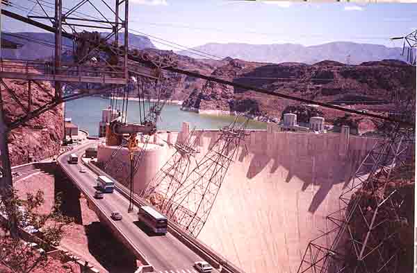
There were wild rams on the hills near the dam, and it promised
to be another hot and sunny day. This was Mother’s Day. We
were going back through Death Valley, with visions of spending the
night in Big Pine, just north of the National Park. We left Las
Vegas without a hitch, and headed north first through Nevada.
Ryolite is a ghost town just out of Beatty. Unfortunately, we
were a year early for the Jamboree, scheduled for April 2002.
This little town had boomed in the early 1900’s after they struck
gold. There is still a Tom Kelly’s bottle house and ruins from
the bank, the school, jail and general store. We lost track of a
hare in the dusty tumbleweed, but following it was fun.
Beatty is a typical two horse town, too hot and not the type
of place one would make a detour to see. I had visions of native
arts and at least a few shopping stops. Mother’s Day is revered
by the native Shoshone band. All the shops and restaurants were
closed. At least we could buy gas though, and prepared ourselves
for a seldom seen thunderstorm in the dusty desert. Since its
occurrence is so rare, Gordon and I decided to pull off the road and
watch the clouds gather and the thunderbolts dance from cloud to cloud,
and the picture perfect
areas of rain under the cumulonimbus.
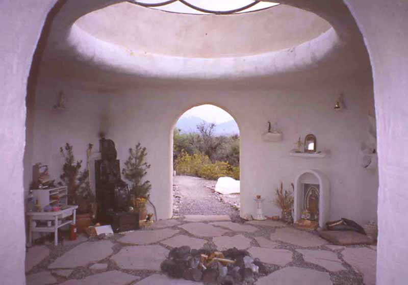
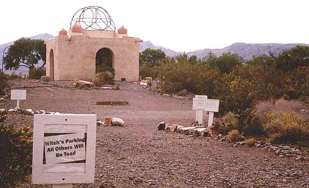
In the middle of the field in front of us was an unusual small domed
structure. This definitely called for an unscheduled
pitstop. Here we were in Cactus Springs and approaching the
Temple of Goddess
Spirituality- Dedicated to Sekhmet. I still haven’t research who
Sekhmet is, but the temple was a one room structure with a fire pit,
an opening to see the stars and let out smoke, and several
doorways.
It was furnished with cushions for floor seating, and later that day
there
would be a special Mother’s Day gathering followed by the blessing of
children.
The parking area had a sign which said Witches Parking only –
all others will be Toad. This is a sacred space to the Shoshone
natives, and clearly their love and respect of the environment is
utmost. Despite the witch’s warning, we parked and at lunch while
the thunderstorm cleared away.
.
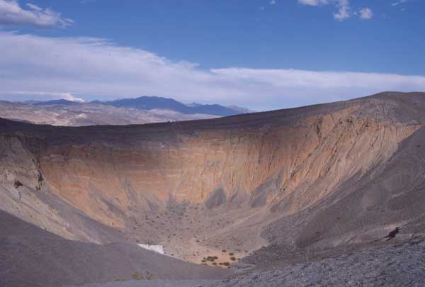
What an interesting day we were having. North again we headed
through Death Valley and to the Ubehebe Crater (affectionately known as
the Heebee geebee Crater). It was my decision to visit
the crater before buying gas. Those who also travel to Scotty's
castle get to see a true oasis, even before getting there. As you wind
up the valley gorge to get there, the palm trees spring up (pun
intended)
and everything is lush The AAA guide said that Scotty’s Castle
would be open until 5:00. We got to Scotty’s at 4:45. The
site was closing up and the gas attendants had left for the day at
4:30.
Oh dear, we definitely did not have sufficient gas to head through the
unpaved and seldom travelled road to Lone Pine. It was hard
to believe that we would be happy to see Stovepipe Wells again, and
really
happy to head up for the night to Mahogany Flats.
Up toward Stovepipe Wells
May 14th saw a splendid morning at MF,with the wind
sounding like the ocean when it blew up the mountain. There are
absolutely no manmade noises there and the silence is awesome.
And so it was until we headed out, this being a travel day. Tioga
pass had been opened finally and we drove up the east side of the
Sierra Nevadas and through the snowy pass back to Yosemite Village.
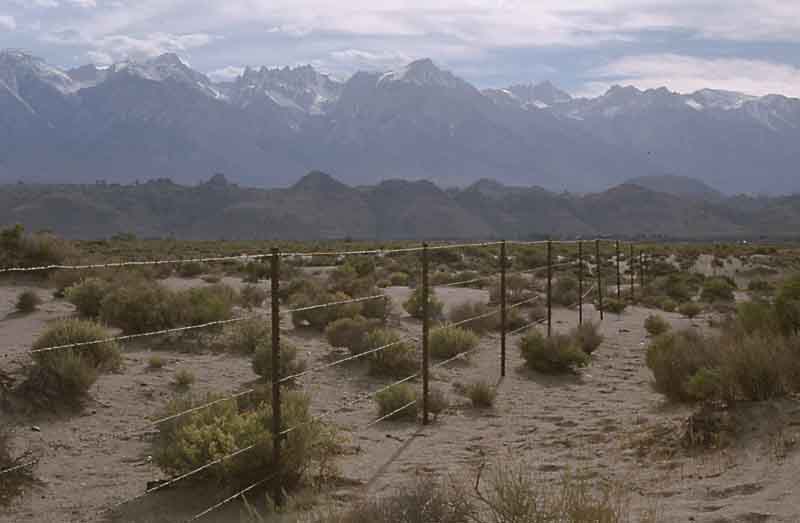
Close to 395 in the vicinity of Mt. Whitney.
Well, we camped one more night in Yosemite Valley after arriving
through the Tioga Pass in the Dark. I was in the doghouse because all
the scenery was missed by coming through late in the day. Oh well...
Anyway, since we were back in the village we took advantage of the
laundry facilities. Near the Housekeeping site the Merced river
flows and the river bed is speckled with gold dust, so we waded in to
try our hand at panning, without the required pan. The river was
ice cold, but the thrill was worth it.
The next day, we packed up and headed for points west, near the Garlic
Capital of the world at Gilroy.. We had a reservation at the Henry Coe
State Park off Hwy 101 up in the hills south of there. It
was very pretty, although the drive to get there took 40 minutes each
way
on narrow winding and switchback roads. Henry Coe State Park is located
at the top of a mountain. It is the type of place you would
expect to be free, and the poor cyclist we passed on the way up should
be paid to go up there. So far up there that from the campground
it is possible
to see Silicon Valley throught long grasses and trees. Gentle breezes
and stars made for a good and restful break from the travel to get
there.
Early morning came and Gordon took the day to visit friends and
former colleagues up in Fremont. I, on the other hand shopped to
my heart’s content at the Gilroy Factory Outlets. It was
necessary, being in Gilroy and all, to try the Garlic flavoured ice
cream (quite good), and browse through one of the shops dedicated
exclusively to garlic. Too bad we weren’t there for the Garlic
Festival.
During our time at Coe, there was time to do a bit of exploring down a
steep wooded slope right behind out campsite. Just before starting back
up to the top there was a glint of color way down in the trees below.
And what was it? Well, the wind must have blown it loose from its
moorings earlier in the season. The Park Ranger was quite surprised to
be given the biggest thing yet for the Lost and Found! (and he hadn't
heard about one being lost)
Meanwhile, Heidi had been studying the maps and it was decided
that Big Sur and the coastline was the next port of call.
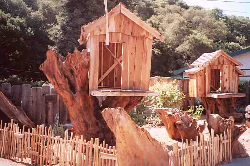
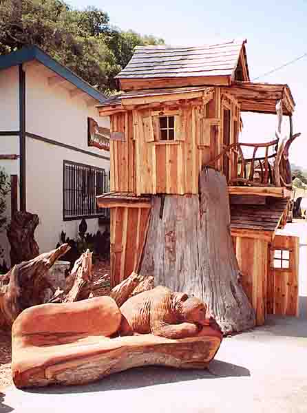
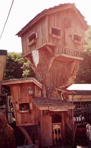
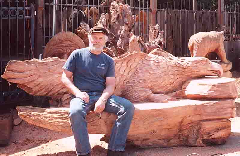
On the way across the Coastal Mountains, we came across a wonderful
carver who would also be the envy of kids who love tree-houses.
A visit to the San Francisco area would be incomplete without a visit
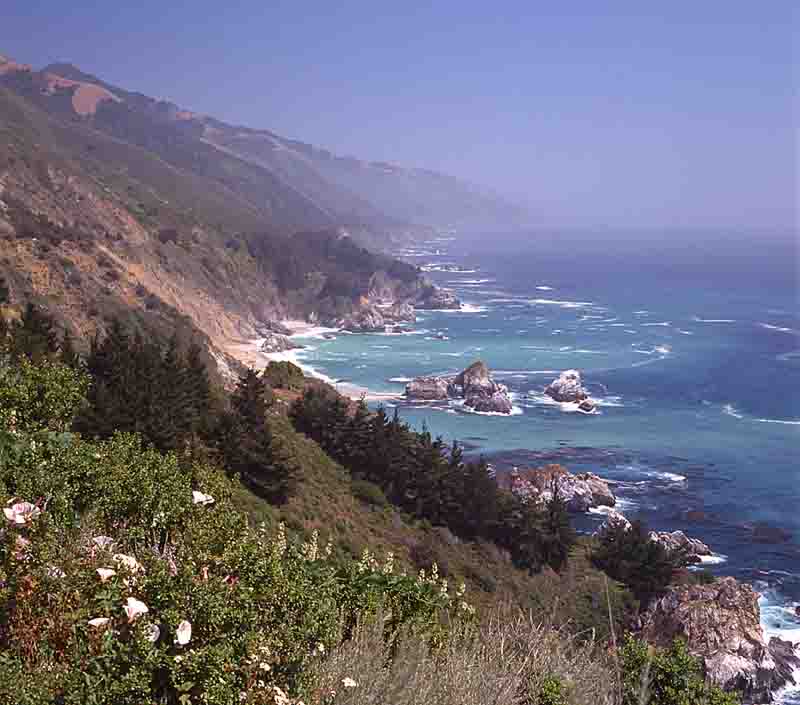
to Big Sur, and we did just that on May 17th, going through Carmel and
taking a leisurely drive on the oceanfront cliff road. We camped
at Pfeiffer State Park and had some excited moments the next day when
Gordon in the truck was waiting in the wrong place for Heidi, who for
her part thought he'd gone off by himself Fortunately we got it
together
after an hour or so of searching, and all was well.
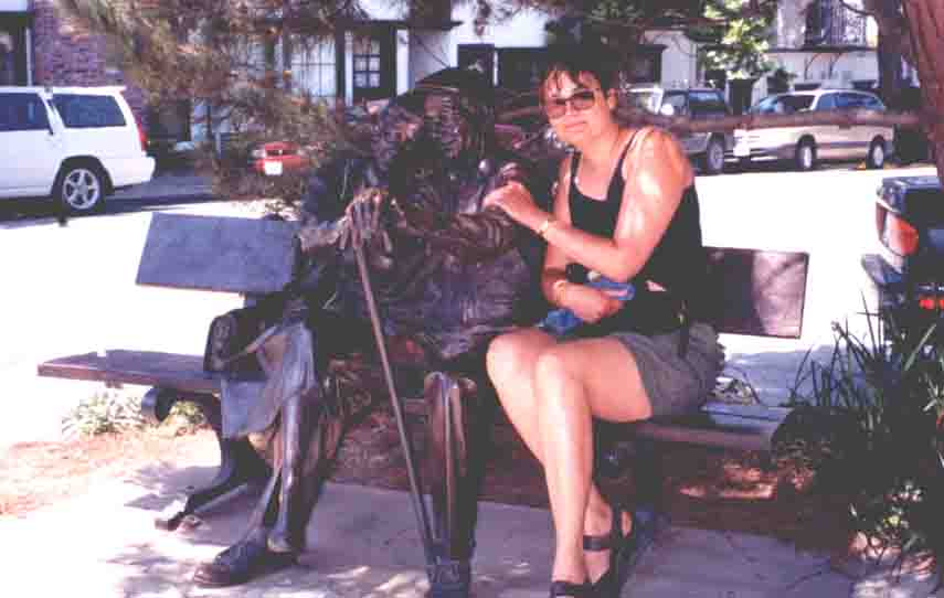
Heidi and friends
Finally, it was back up into San Francisco. We visited the
necessary Chinatown (having a scrumptious lunch there), Golden Gate
Park and the Breakers where they were preparing for a very large Gay
Pride parade. We had supper at the famous Rocco's and
walked
amidst the huge number of Street People, complete with shopping carts
and sleeping mats in doorways. Nearby, to be close to the airport
the next day, we stayed at the downtown hostel (YMCA), which is
a fine old building with a great past.
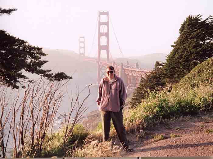
And of course, no trip to San Francisco environs would be complete
without the Golden Gate Bridge!
And remember that when it comes to Nature: Look at it, Photograph it,
and Leave it
Till next time,
Heidi & Gord, with postscript picture from Toller, who
wants his Mistress back